61
User Manual
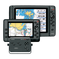
5. C-LINK
E
5.1 C-LINK
E
C-Link
E
system is a feature which allows to sharing the same cartographic data
between two Chart Plotter units linked via serial I/O port.
In order to activate C-Link
E
function, a “MAX data C-CARD” (called REGULAR C-
CARD) must be inserted into one of the two chart plotters and a special MAX data
C-CARD (called MIRROR C-CARD) must be inserted on the other chart plotter.
The two MAX data C-CARDs must have the same code and revision. So, the
MIRROR C-CARD can be utilized only on a chart plotter linked to another chart
plotter provided with the equivalent REGULAR C-CARD.
It is important to point out that the two chart plotters must have the update
software versions that allow C-Link
E
function.
How C-Link
E
system works
When the chart plotter is powered up, it switches into the “Stand-Alone Mode”. In
this work mode, the chart plotter unit periodically scans all the available C-CARD
slots searching for MIRROR C-CARDs. When one or more MIRROR C-CARD is
found (in one or both chart plotters) a special connection is established between
the chart plotters to enable the MIRROR C-CARDs. If a regular C-CARD which has
previously activated a MIRROR C-CARD is removed, even the MIRRORs C-CARD
will be not read anymore on the other unit.
C-Link
E
serial connection
The two chart plotters should be connected via serial ports. Any of the available
ports can be used, the software will recognize automatically the serial ports used.
A typical connection is as follows:
Chart Plotter 1 Chart Plotter 2
TX —————> RX
RX <————— TX
GND <————> GND
5.2 C-LINK
E
NAVIGATION DATA TRANSFER
This function allows transferring C-Link
E
Navigation Data (Route Name, Destina-
tion ID & Position, Next Waypoint ID & Position, Total Route length, Fuel Con-
sumption Rate, ETA, TTG etc.) between two chart plotters linked through the
C-Link
E
system.
The chart plotters can be set to operate in two modes:
♦ MASTER mode (Primary Chart Plotter)
♦ SLAVE mode (Secondary Chart Plotter)
When the navigation is activated on the Master chart plotter, the C-Link
E
naviga-
tion data will be continuously sent to the Slave until the navigation is active.
If the Master is navigating to a Single Destination, the Slave will show the Desti-
nation position and activate the navigation to it.
If the Master is navigating to a Route, the Slave will show the Route Leg com-
posed by the Destination and the Waypoint after the Destination (Next Waypoint)