Do you have a question about the abem Terrameter LS and is the answer not in the manual?
Describes typographical conventions and special message formats used in the manual.
Introduces the Terrameter LS as a state-of-the-art data acquisition system.
Details shipped items, inspection procedures, and packing for shipment.
Covers shipping damage claims, repacking, and instrument registration process.
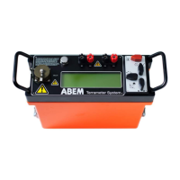
Describes the various connectors on the instrument's right side panel.
Details the power panel, including the emergency stop button and its operation.
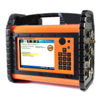
Explains the built-in GPS and the main user interface panel components.
Discusses power sources, battery status, and safe operation in various conditions.
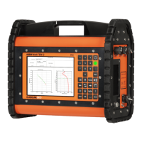
Explains the screen layout, navigation menus, and status bar elements.
Details built-in keyboard buttons and their functions for user interaction.
Maps built-in buttons to corresponding keys on a standard USB keyboard.
Explains how to navigate the instrument's menu tree and change instrument views.
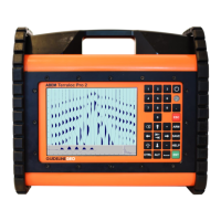
Describes the initial screen displayed upon instrument startup.
Explains using option menus and methods for editing text and numerical values.
Details alphanumeric and numeric emulators for entering data.
Introduces and explains Projects, Tasks, and Templates for data handling.
Defines Tasks and explains their creation, management, and settings.
Explains saving measurement configurations as Templates for reuse.
Advises on pre-field work, site selection, and hardware setup for measurements.
Covers receiver, transmitter, and IP settings for data acquisition.
Guides on creating stations, cable exclusion, and performing measurements.
Covers general geoelectrical imaging, essential and recommended equipment.
Explains 2D/3D imaging, cable arrangement, and borehole tomography.
Guides on starting, pausing, stopping, deleting data, VES, and error handling during acquisition.
Covers proper system repacking and methods for exporting measurement data.
Details exporting various data formats, managing projects, and updating software.
Explains network setup, file management, data transfer, and software updates.
Guides on self-tests, cable checks, remote diagnostics, and malfunction handling.
Lists general, measuring, transmitter, and receiver specifications.
Covers receiver channel capabilities, relay switch matrix, and software/communication details.
Explains measurement modes including SP, DC resistivity cycles, and IP timing definitions.
Defines XML spread files, including cable, electrode, and switch address details.
Explains protocol files in XML, ADR, and ORG formats for various arrays and configurations.
Covers geometry files for borehole measurements and lists standard spread and protocol files.
| Number of Channels | up to 8 |
|---|---|
| Connectivity | USB, Bluetooth |
| Measurement Principle | Electrical Resistivity and Induced Polarization |
| Category | Geophysical Instrument |
| Power Supply | 12 V DC external battery |
| Data Storage | Internal Memory, USB |
| Operating Temperature | -10°C to +50°C |
| Storage Temperature | -40°C to +70°C |
| Display | LCD |
| Measurement Modes | Resistivity, IP |
| Electrode Configuration | Dipole-dipole, Wenner, Schlumberger |