Start up with manual acquisition
98-144390-A Chapter 3: Assembly & start up 3-7
To acquire a satellite signal
1. When the status screen is displayed press on the keypad to go to the page MANUAL
POINTING.
The Power and Fail/Pass LEDs are steady green, and the LED Logon is off. Make sure no
hardware failures or error codes are present, check the display for events.
2. Adjust the elevation, based on the ACU’s calculated elevation look angle by coarsely
adjusting the angle and then engage the elevation brakes (3).
3. Make fine adjustment so that the target and current elevation angles match each other
as closely as possible.
4. Adjust the azimuth angle until the GX signal is detected. The signal strength is shown in
the display. Use a compass tool to find the pointing direction.
If the terminal base is not completely level, the current elevation angle will change
during an azimuth sweep. When the angle has changed more than 0.3 degrees, adjust
the elevation angle again and continue the azimuth sweep.
5. When a strong signal is displayed, tighten the azimuth brake (2) approximately 90% of
the way.
If no signal is located, modify the elevation look angle by 1 degree above the target
elevation angle and repeat the azimuth sweep. If no signal is located, repeat azimuth
sweep with 1 degree below the target elevation angle.
6. Fine-tune the azimuth angle to get strongest possible signal strength.
7. After a peak signal is acquired, fine-tune the elevation angle until the system finds a
peak.
8. Repeat the previous two steps until you have the strongest possible signal strength.
9. Fully engage the azimuth brake (2).
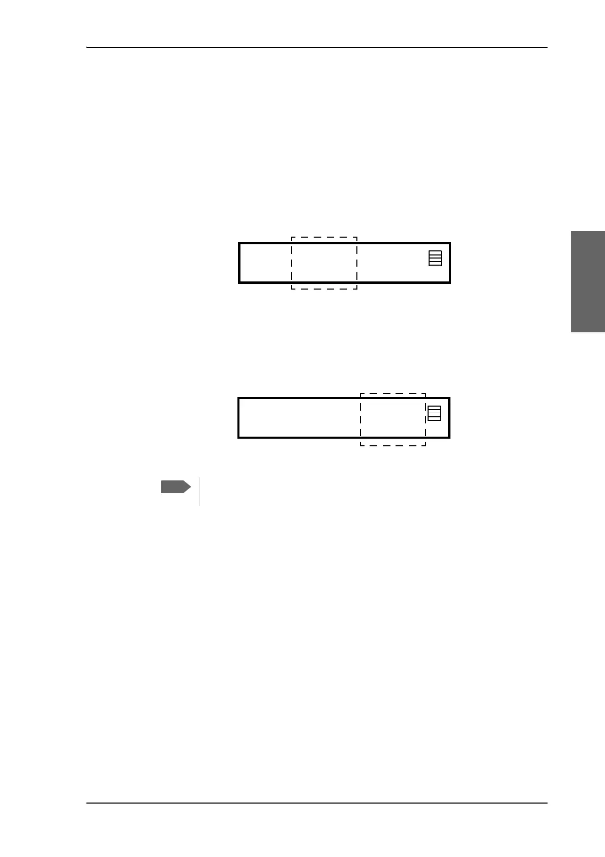
Figure 3-12: Target and current elevation axis angles
Figure 3-13: Current signal strength
The best method to manually locate a satellite is typically to sweep in azimuth
slowly back and forth until you peak on the signal.
MACQ-1 NAV:G- MDM: INIT LAN:----
AZI ELE SIG:
124.6 12.6 12.6 198
V
SAT: 062.6 E RX:--L 19.707/18.250 TX:maR
MACQ-1 NAV:G- MDM: INIT LAN:----
AZI ELE SIG:
124.6 12.6 12.6 198
V
SAT: 062.6 E RX:--L 19.707/18.250 TX:maR