Operation
Page 13
The information displayed on this screen includes:
● MMSI - the Maritime Mobile Service Identity for the vessel on which the transceiver is installed.
● Vessel name
● Call sign
● Destination - the current voyage destination
● IMO Number (where applicable)
● ETA - Estimated Time of Arrival at the voyage destination
● Draught
● Navigational status - At anchor, underway etc
● Dimensions for internal GNSS antenna
● Crew - number of crew on board
● Type of ship/cargo
The scroll wheel can be used to highlight an item of static or voyage data. To edit voyage or installation data see
the ‘Voyage data’ and ‘Installation’ menus in section
3.16 and also the installation information in section 4.
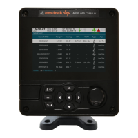
3.7 Own dynamic data
This screen shows current dynamic data from sensors connected to the transceiver and / or its built in GNSS
receiver. This is live information that is being periodically transmitted to other AIS equipped vessels.
The information displayed on this screen includes:
● Current date and time (UTC)
● Latitude
● Longitude
● SOG (Speed Over Ground)
● COG (Course Over Ground)
● Heading
● ROT (Rate Of Turn)
● Position accuracy
● RAIM status
● GNSS in use (internal or external)
Figure 7 Own dynamic data screen