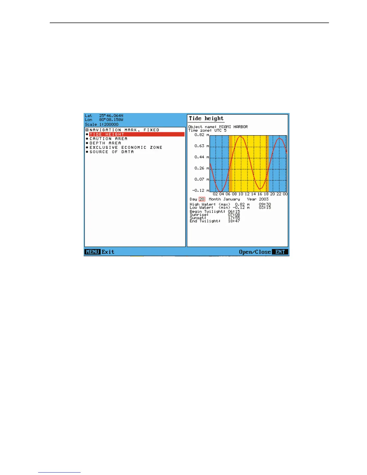
CR44/54 C-MAP attributes Appendix C-5
Year Use the cursor (right side) to go to the year. Toggle to a different year
with the +/- keys.
The last four lines in the tide display will inform of Begin and End
Twilight, Sunrise and Sunset for the selected date.
Example of Tide height information:
Caution - the tide information system is quite accurate. However, the predic-
tions are subject to variables, which, like the weather, are beyond the control
of man. The tide predictions are based on normal weather conditions. Hur-
ricanes and strong winds will often have a strong influence on the water level,
which can vary several meters. Changes in a coast line, either due to natural
erosion, major storms or larger man-made constructions, like breakwaters or
dredged canals, can also have influence on the local tide situation.