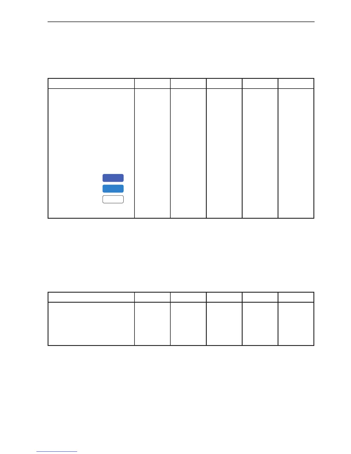
CR44/54 Chart menu and INFO windows Chapter 4-19
Level: Depth
The default settings in this level are fixed in all display modes, except for
*Custom where it is possible by the user to alter the features.
These C-MAP features are not available in GRID display mode.
C-MAP features
Full *Custom Simple Fishing Low
Soundings
Underwater objects
Depth Lines
Depth Lines>
Depth Lines<
Depth Areas
Depth
Level 1
Level 2
Level 3
ON
ON
ON
0000m
9999m
ON
0-002m
2-009m
9-MAX
ON
ON
ON
0000m
9999m
ON
0-002m
2-009m
9-MAX
ON
ON
ON
0000m
5m
ON
0-002m
2-009m
9-MAX
ON
ON
ON
0000m
9999m
ON
0-002m
2-009m
9-MAX
OFF
ON
OFF
0000m
5m
OFF
0-002m
2-009m
9-MAX
Level: Presentation
The default settings in this level are the same for all display modes, except
GRID, which do not include C-MAP features. The features can be changed
from FILLED to CONTOUR in all the display modes mentioned below.
C-MAP features
Full Custom Simple Fishing Low
Land areas
Depth areas
Caution areas
Dredged areas
FILLED
FILLED
FILLED
FILLED
FILLED
FILLED
FILLED
FILLED
FILLED
FILLED
FILLED
FILLED
FILLED
FILLED
FILLED
FILLED
FILLED
FILLED
FILLED
FILLED