›
Distance and time to the city with the following navigation instruction including
numeric indication of the remaining distance;
›
Information on the next points of interest (e.g., fuel stations, car parks) is dis-
played.
Traffic signs
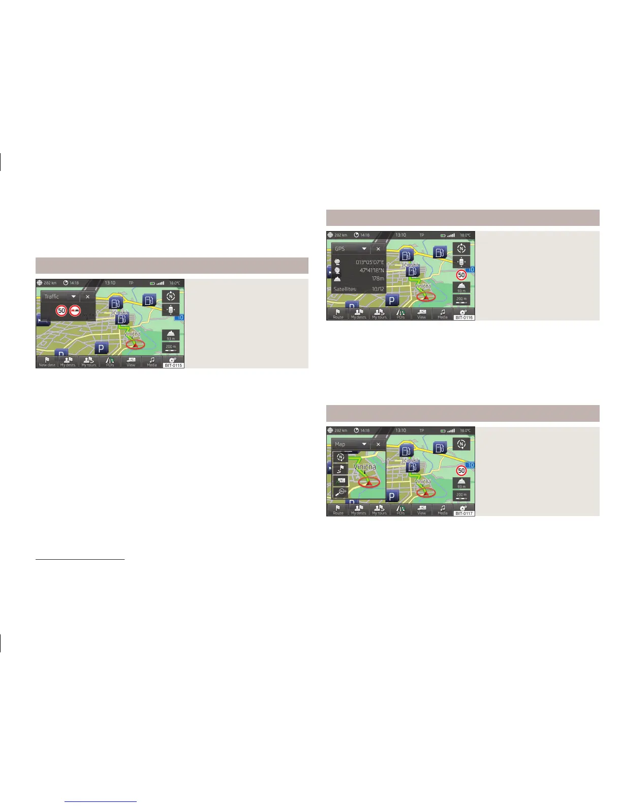
Fig. 30
Split screen: Traffic signs
The Traffic split screen displays traffic signs.
Up to three traffic signs and three additional traffic signs can be displayed.
If the message No traffic sign available are displayed in the split screen, the front
camera did not recognise any traffic sign or you are outside the range of the navi-
gation data.
Further information » page 47.
GPS
Fig. 31
Split screen: GPS
The GPS (Global Positioning System) split screen displays information on the cur-
rent geographical position of the vehicle.
Displayed information
■
- Longitude
1)
■
- Latitude
1)
■
- Elevation
2)
■
Satellites: - Number of received/available satellites
Map
Fig. 32
Split screen: Map
An additional map is displayed on the Map split screen.
1)
To display the longitude and latitude, the signal from at least three satellites must be received.
2)
To display the elevation, the signal of at least five satellites must be received. Also, the route guid-
ance must not be running in demo mode.
49
Set-up
 Loading...