IFD500 Series Pilot Guide
4-12 Map Subsystem
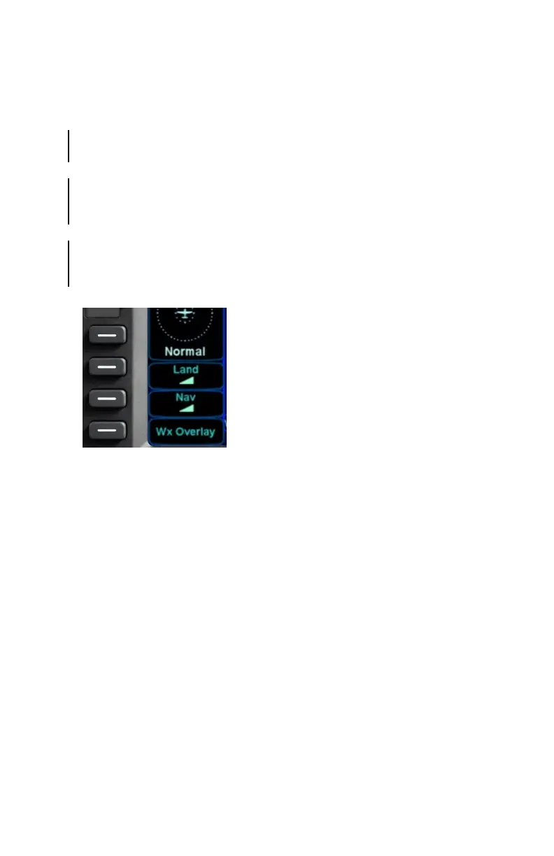
DECLUTTERING THE MAP
Two LSKs along the left edge of the display, “Land” and “Nav”, allow
for separate control of the information density of the land map
features (e.g. terrain, political boundaries, rivers, lakes, oceans,
roads, etc.) and the navigational map features (e.g. airspace, Victor
and Jet airways, airports, obstacles, navaids, etc.), respectively.
Use the “Land” and/or “Nav” LSK to select the preferred level of
feature density. The selected levels remain consistent across all
maps shown on the IFD.
Map Declutter Controls