IFD500 Series Pilot Guide
5-50 Aux Subsystem
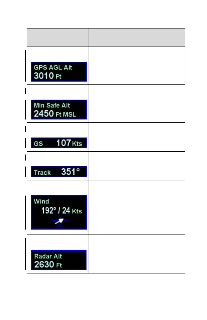
Datablock Item Title
and Image
Computed AGL altitude based on GPS
altitude.
Min Safe Altitude (defined as 1000’
above the highest terrain or obstacle in
a 10nm rectangle around the aircraft
position).
Wind speed and direction, and an
arrow indicating direction of the wind
relative to the nose of the airplane.
Populates in air. Displays as “Calm”
when 5 knots or less.
Note: Requires TAS and Heading
from an external device like an EFIS.
AGL altitude from a radar altimeter.
Note: requires radar altimeter input