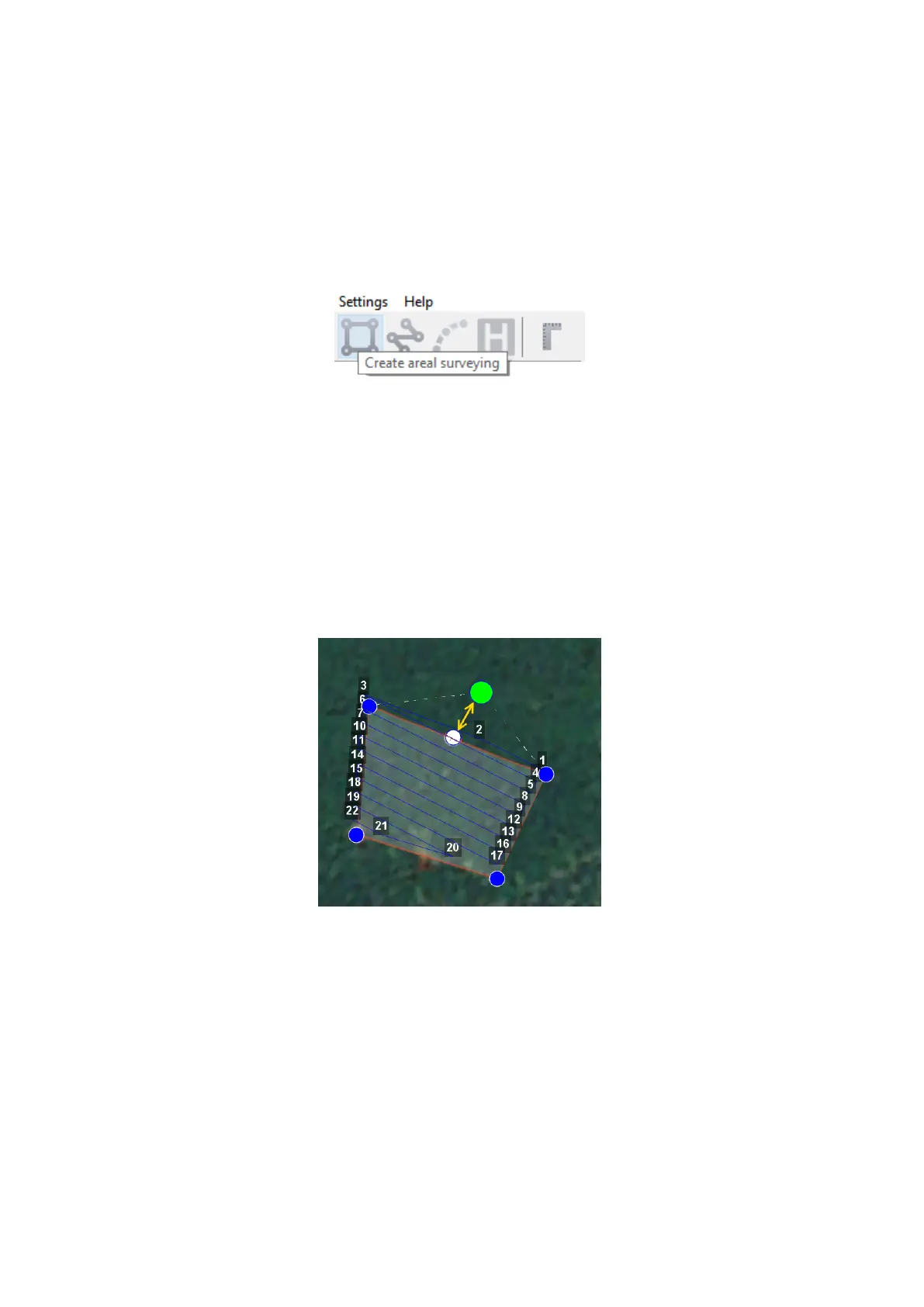
Aerial surveying
Aerial surveying is a polygon surveying. User sets vertices of the polygon (more than
3) and the software will automatically calculates a flight route.
1) Press Create aerial surveying on the toolbar.
Create aerial surveying
2) Click on the map to set vertexes of aerial survey area. The program will automatically
calculate the flight route.
Adding And Removing Of Polygon Vertexes
You can add vertices to polygon.
1) Hold left mouse button and move middle point of a polygon side.
Vertex adding
The vertex will be created automatically. A floating window will display location of the
vertex.
To remove the vertex:
29