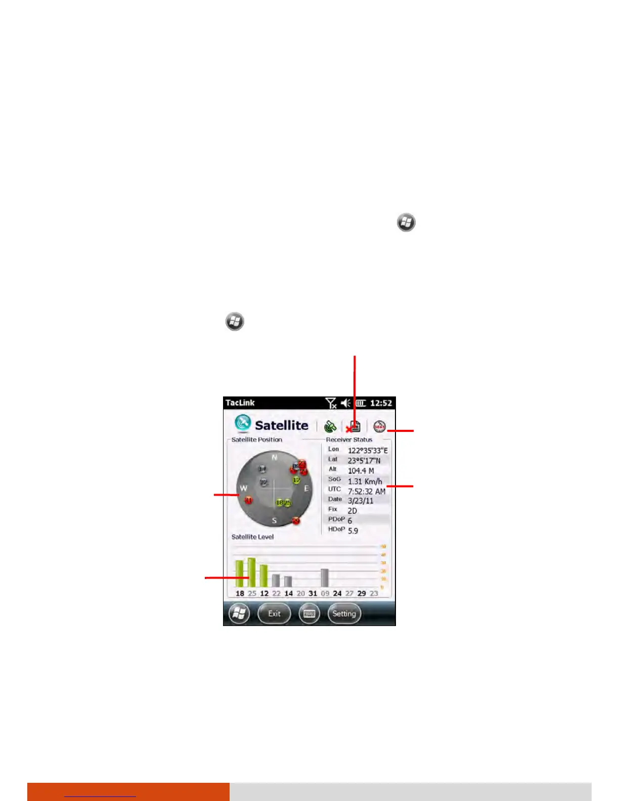
EasyManuals Logo

Getac PS336 User Manual

Getac PS336
133 pages
To Next Page IconTo Next Page
To Previous Page IconTo Previous Page
Page #110 background imageLoading...
Page #110 background image
6-28
More Programs
TacLink
The TacLink program receives GPS satellite signals to calculate the location
of your device. You can also record a NMEA log file for the use of other
applications.
NOTE: TacLink only supports NMEA format. TacLink will not start if you
have set the GPS output format to Binary Mode in
Settings
System GPS Mode for the need of third party programs.
Running TacLink
To run the program, tap TacLink.
A message appears if positioning is not completed in 10 minutes.
To exit the program, tap Exit at the bottom left of the screen.
S
hows the overhead
satellite positions.
Shows the signal strength
of the satellites.
Shows the result of GPS
positioning.
A minimum of
4 GPS satellite signals is
needed to calculate your
GPS position.
A red X indicates logging is not
activated. No X indicates logging is
activated.
This icon appears only if SBAS
is enabled. (See the next
section for information.)

Table of Contents

Other manuals for Getac PS336

Questions and Answers:

Question and Answer IconNeed help?

Do you have a question about the Getac PS336 and is the answer not in the manual?

Getac PS336 Specifications

General IconGeneral
BrandGetac
ModelPS336
CategoryHandhelds
LanguageEnglish