11
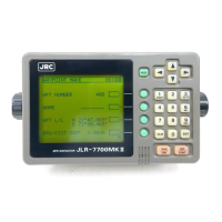
JLR-7700 MK2 GPS Navigator
1. Equipment Overview
1.1 Functions
The JLR-7700 MK2 is a DGPS navigation equipment configured by connecting the NNN-4331 DGPS re-
ceiver to the NWZ-4570B navigator. The DGPS navigation equipment measures the vessel position all the time
with very high accuracy using the data provided by the GPS satellites under any geographical or weather
conditions and its measurement accuracy can be further enhanced by receiving compensation data from the
DGPS beacon station. The equipment displays the following navigation screens and GPS statuses based on
data retrieved by the DGPS receiver.
(1) Navigation screens
These screens display the navigation information to go to the destinations that have been preset to the
equipment.
(2) Satellte status screens
Screen name Remarks
NAVIGATE screen The current position is displayed with the latitude and longitude. Information required
for navigation, such as the bearing, distance, course, and speed to the destination,
can also be displayed. Other navigation information, such as the deviation from the
preset navigation course, direction to steer, and estimated time of arrival to the
destination can be displayed. In addition, the Loran time difference can also be
displayed as well.
COURSE The course deviation can be graphically shown on the display by selecting the CDI on
DEVIATION IND. the NAVIGATE screen. In addition, the direction to steer will also be displayed.
screen
PLOT screen The planned navigation course and actual navigation tracked by your vessel can be
graphically displayed. The waypoints can be displayed with symbols and alphabets.
The current position can be registered as the waypoint by simply pressing the
key.
1
EVENT
Screen name Remarks
SAT STATUS Which provides the operator with the GPS information (the satellite number, elevation
screen angle, azimuth angle, and signal level).

 Loading...