Conguration
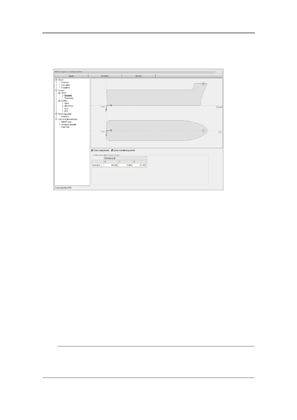
Figure22GNSSsensorgeometrycongurationview
5.5.2GNSSprocessing
Foroperationswithweaksatellitegeometry,theuseofheightaidingand/oralower
elevationmask,mayimprovethepositionavailability.
AvailableheightaidingmodevaluesareFilterandOff.Theheightaidingmodeis
normallysettoFilter.InheightaidingmodeFilter,theprocessingsoftwarewillusethe
averagedantennaheightmeasurementasacontributiontothepositionsolution.For
operationswithvaryingheight,heightaidingmodeshouldbesettoOff.
Theelevationmaskhasadefaultvalueof10degrees,whichistherecommendedsetting
formostscenarios.UnderspecialconditionstheElevationmaskmightbechangedin
ordertoimprovethesatellitegeometryorreducemultipath.Therecommendedvalue
rangeisfrom7to15degrees.
Thepositionintegritystatusindication(Safe,Caution,Unsafe)isbasedontheposition
Accuracylevel.Thevessel'soperationalmodemayrequiretheaccuracyleveltobe
modied.Thedefaultvalueis10m.IftheEPEvalueislargerthantheaccuracylevel,
thesystemintegritystatusisindicatedasUnsafe.
TheIonosphereactivityvalueisusedtoindicatethelevelofionosphericactivity.
AvailablevaluesareNormal,MediumandHigh.ThedefaultvalueisNormal.
Note
Duringperiodswithincreasedionosphericactivity,thisvalueshouldbesettoHighfor
optimizedsystemperformance.Distantsinglefrequencyreferencestationswillthenhave
lessinuenceonthepositioncalculations.
G210-14/3.0
57