Chart menu and INFO windows Chapter 4-23
attractions. Place the cursor on the chart symbol to call up an info window and
press [ENT] to call up information on the attraction.
Quick chart info - placing the chart cursor on a C-MAP object will activate a
small info window with details on the object. Info window will automatically
close after 10 seconds or when cursor is moved away.
Rotation resolution - can be set to adjust the chart for each 5, 10, 15, 20 or
25° changes in relation to present course or heading.
Show range - can be set to WITH BACKGROUND, ON or OFF:
WITH BACKGROUND - will add a small line to the chart display indicating
that the length of the line equals a certain number of nautical miles/km - the
indication is highlighted with a background color.
ON - same as above, but without background color.
OFF - indication is not shown on chart.
Soundings -
can be set to ON or OFF.
ON - the information will be shown as selected i.e. in feet, fathoms or meters.
OFF - soundings are not shown on chart.
Tidal currents (NT MAX only) - can be set to ICON, ON, OFF:
ICON - will show icons (a diamond shape with the letter c in it). Place the cursor
on the icon to call up an info window, then press [ENT] to call up tidal current
information on the location.
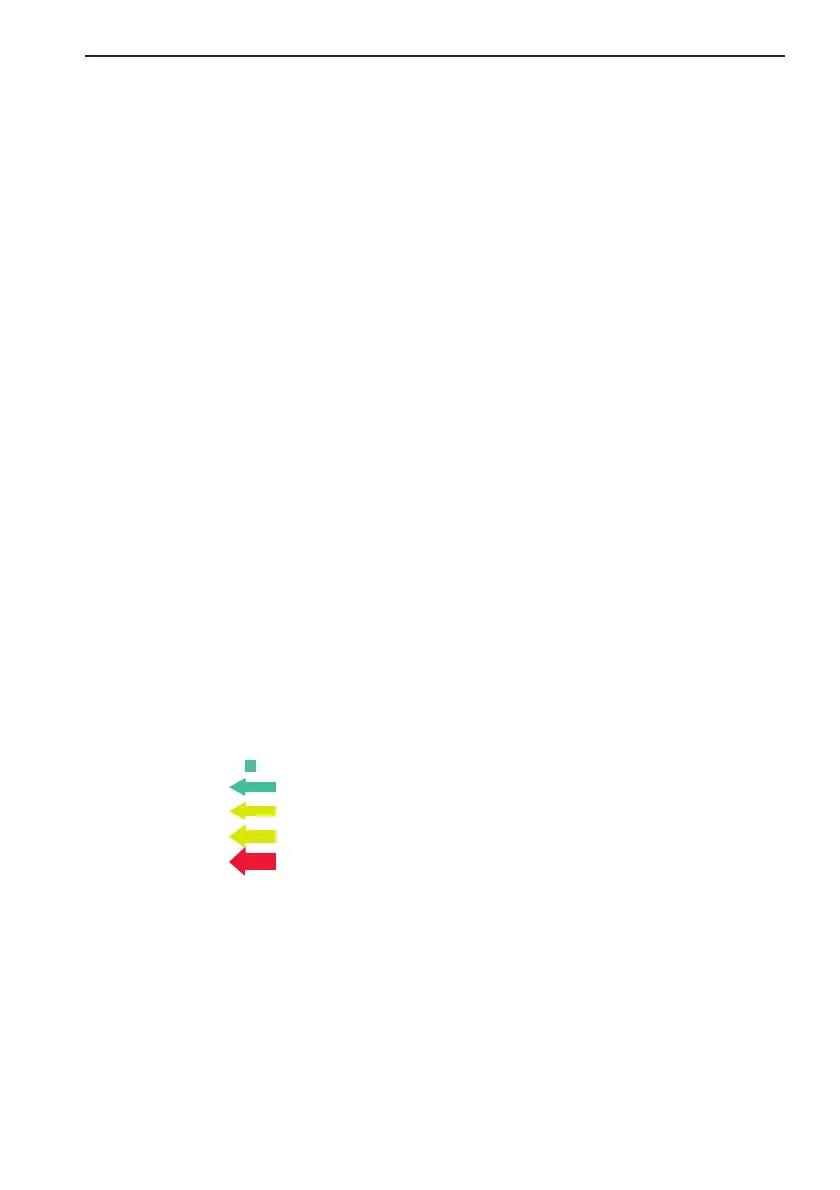
ON - will indicate the speed and direction of the current by means of colored
arrows, as shown below:
0 to 0.1 kn -
Green
0.2 to 1.0 kn -
Green
1.1 to 2.0 kn -
Yellow
2.1 to 3.0 kn -
Yellow
3.1 to 9.9 kn -
Red
Traffic - when set to ON, the chart will indicate roads, railroads, etc.
Underwater objects - can be set ON or OFF.
Value added data (NT MAX only) - when set to ON, additional data on
wrecks, cables and pipelines, sailing directions, bathymetric info, etc. will be
available.
CX34/44/54 Operator manual