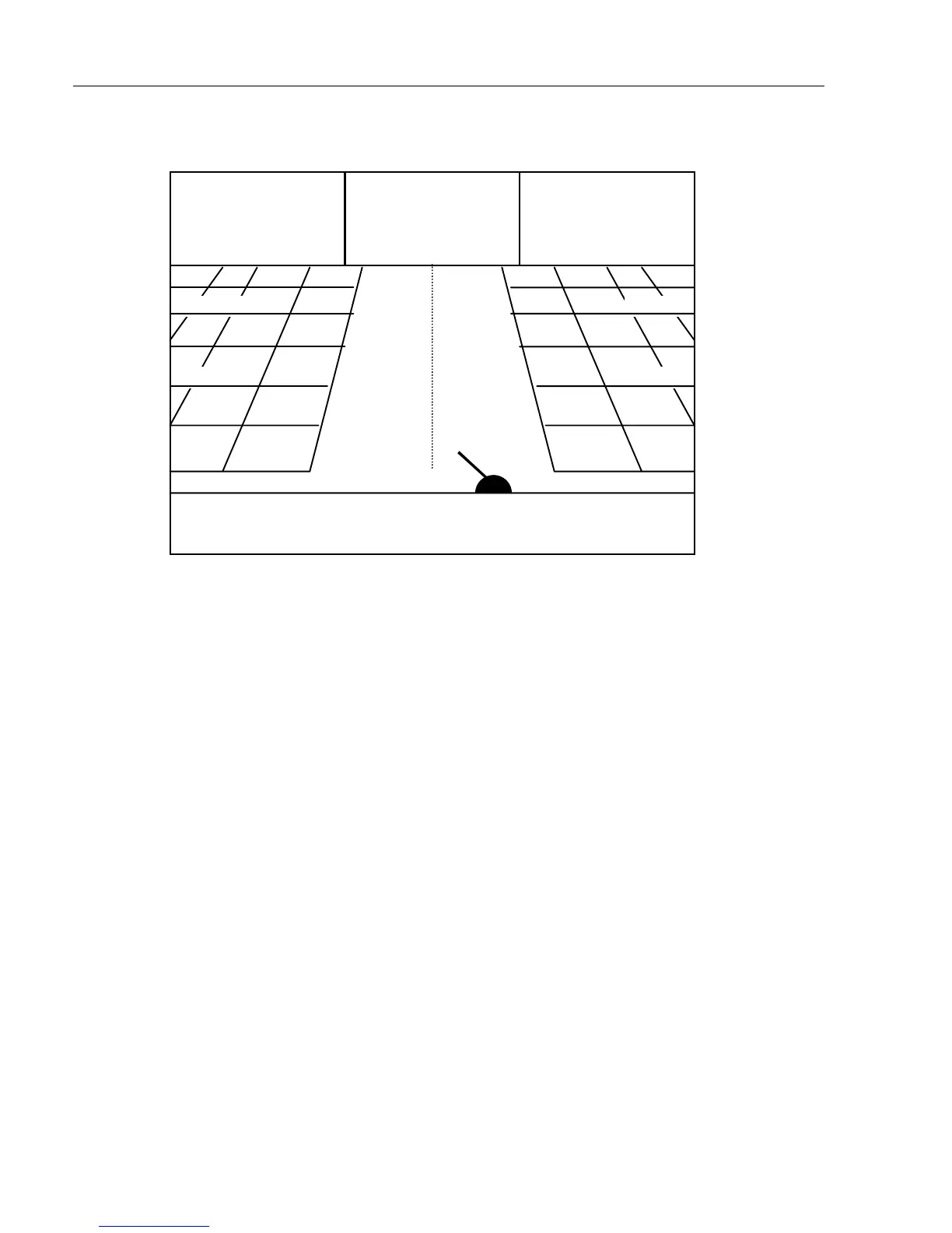
NAVIGATION IS ON
S8.2
V7.4
C359
°
°°
°
B314
°
°°
°
X0.011
D17.3
0.04nm
0.02nm
0.02nm
0.04nm
0.02nm
0.02nm
Nautical
miles indi-
cation on
horizontal
lines indi-
cates how
many
nautical
miles there
are from
ship’s posi-
tiontothe
horizontal
line.
C: Course over ground
X: Cross track error
S: Speed over ground
B: Bearing to approaching WP
D: Distance to waypoint
V: Speed towards WP (velocity)
Bottom line indicates name of waypoint or route.
n
Ship’s position and heading in relation to intended track.
n
o
Ideal course line between two waypoints starting from ship’s
position when NAV is activated on connected navigator.
p
XTE alarm lines – an alarm will sound if the ship touches the
lines.