GN33 C-MAP attributes Appendix C-5
The last two lines in the tide display will inform of Sunrise and Sunset for the
present day.
Caution - the tide information system is quite accurate. However, the predic-
tions are subject to variables, which, like the weather, are beyond the control
of man. The tide predictions are based on normal weather conditions. Hur-
ricanes and strong winds will often have a strong influence on the water level,
which can vary several meters. Changes in a coast line, either due to natural
erosion, major storms or larger man-made constructions, like breakwaters or
dredged canals, can also have influence on the local tide situation.
Objects organized in categories
The purpose of the C-MAP functions is to select objects, which are to be dis-
played on the screen (chart). The objects are organized in categories and each
category can be selected as one, without having to decide upon almost 300
objects separately. Refer to section 3.4 Chart setup.
The following functions are used to enable/disable visualization of the catego-
ries listed below:
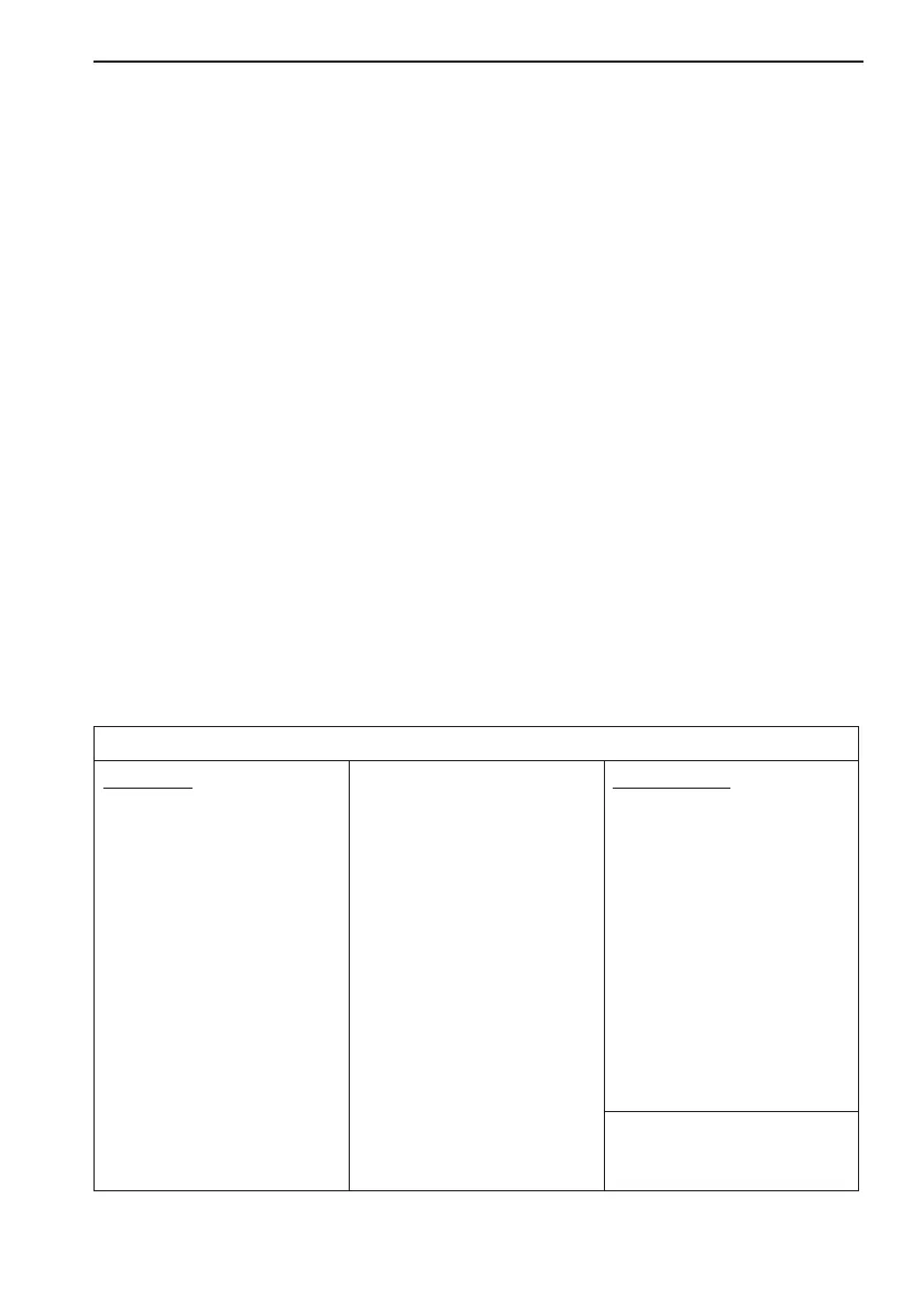
LAND SETTINGS
Features:
Land area and coastline
Hill, dune area
Land contour lines
Salt pan
Slope topline
Tree point
Vegetation area
Lake
Waterfall
Airport area
Built-up area
Railway
Road in general
Overhead cable, w/pylons
Overhead pipeline
Fence line
Telepher ic
Bridge
Tunnel, tunnel entrance
Landmarks:
Building, religious / single
Cemetery
Fortifid structure
Siloway route part
Tank, chimney
Dish aerial
Radar dome
Flagstaff / Flagpole
Flare stack
Mast, tower
Monument
Windmill, windmotor