■Search Route: Tap [Search
Icon] on the top right corner to
search the route by entering the
keyword.
Enter Route Name
* Note: Continue to swipe down
on the Route List, more relevant
routes will be listed.
* Note: During offline, the fixed
thumbnail map will appear in front
of the Route.
* Note: In case GPS is not
positioned, tap [Nearby Route]
will not able to search any route.
If this occurs, please wait after
GPS is positioned, then try to use
this function again.
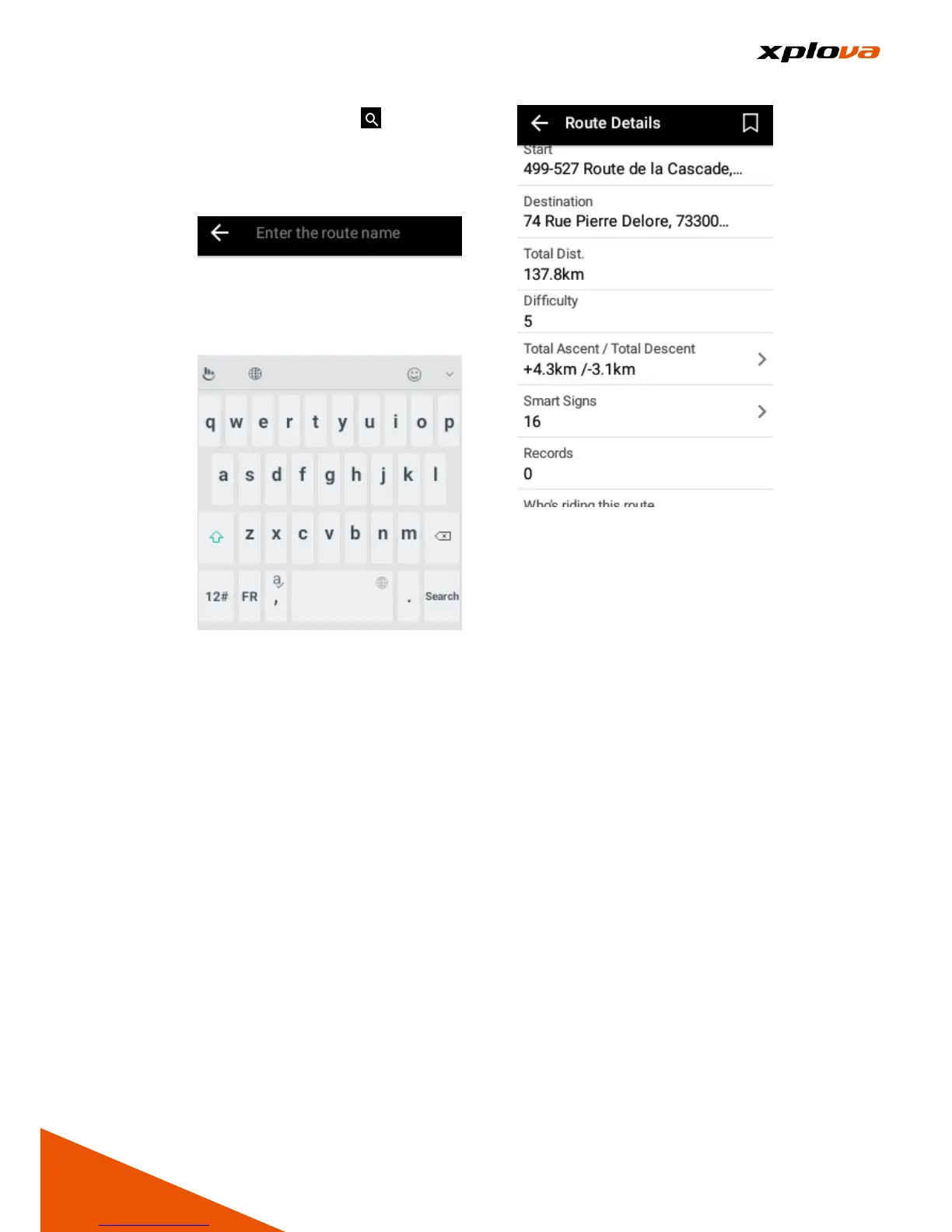
5. Route Information: Select any
route, the map screen on the top
will display this Route and then
mark it with Smart Sign™. The
Route Information on the bottom
has the following information:
■Starting point: Indicates the
Location and Information of the
Route Starting Point. Tap to
display the Starting Point in the
middle of the map.
■Total Distance: The total
distance of this Route.
■Level of Difficulty: Represents
the difficulty of the Route, the
larger that number, the more
difficult the Route.
■Total Climb / Total Descent: Total
distance of the Climb and
Descent of this Route.
■Smart Sign™: The Number of
Smart Signs included in this
Route.
■Exercise Record: The number of
public record that people is using
this Route. Tap to view the rider's
public record results.
 Loading...