Do you have a question about the Eclipse AVN5500 and is the answer not in the manual?
Defines the WARNING sign indicating potential death or serious personal injury.
Defines the CAUTION sign indicating potential personal injury or property damage.
Defines the ATTENTION sign indicating helpful information that should be remembered.
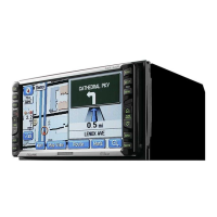
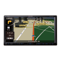
Explains the device's GPS navigation capabilities and how it functions.
Provides an overview of the Global Positioning System and its role.
Covers adjustments for screen display and audio output settings.
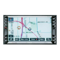
Explains various methods for searching and displaying map data.
Lists categories of Points of Interest that can be displayed on the map.
Guides users on finding Points of Interest near their current location.
Guides on how to find map locations by entering a specific address.
Explains how to search for map locations by Point of Interest name.
Explains how to find nearby emergency services like police or hospitals.
Details how to find map locations using freeway exit or entrance names.
Explains how to find map locations by entering geographical coordinates.
Explains how the device shows the vehicle's current location on the map.
Details how to display maps using pre-registered memory points.
Explains how to find map locations by entering street intersection names.
Guides users on setting destinations and initiating route searches.
Covers the procedures for managing route guidance sessions.
Explains the process of setting a destination on the map.
Guides on setting destinations using pre-registered home or special points.
Details the process of the device searching for optimal routes.
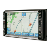
Shows the complete route from the starting point to the destination.
Describes the information and controls available on the all-route display screen.
Explains how to view or avoid restricted road segments.
Shows detailed route information, including road names and distances.
Explains how to search and display up to three route options simultaneously.
Details methods for modifying the route after an initial search.
Guides users on adding multiple destinations to a route.
Allows modification of route search criteria for specific segments.
Explains how to reorder multiple destinations in a route.
Guides users on removing destinations from a planned route.
Explains how to mark a road as a transit point for route planning.
Covers the system's audible navigation instructions.
Details how to perform a new route search while guidance is active.
Covers the automatic route recalculation when deviating from the planned path.
Explains how to modify existing route search results.
Describes how to set a destination with a single touch on the map.
Explains how to set destinations by selecting points on a map.
Details the process of bypassing restricted road sections.
Explains how to initiate the navigation guidance process.
Explains how the device provides guidance for upcoming intersections.
Details how to temporarily stop and resume route guidance.
Introduces the concept and purpose of registering geographical points.
Details operations for managing memory points, including home and special points.
Details how to save important locations as memory points.
Covers managing special memory points, which offer quick access.
Guides users on how to register their home address for easy route searching.
Explains how to manage detour points to avoid specific areas.
Details how to perform a system diagnostic check on the device.
Covers the functionality and usage of the optional rear view camera.
Provides guidance on correcting location and distance inaccuracies.
Discusses potential inaccuracies and errors in positioning and guidance.
Index entries related to the route guidance system.
| Touchscreen | Yes |
|---|---|
| GPS Navigation | Yes |
| Rear Camera Input | Yes |
| DVD Player | Yes |
| AM/FM Tuner | Yes |
| Video Input | Yes |
| Display Type | LCD |
| Audio Formats Supported | MP3, WMA |
| Video Formats Supported | MPEG |
| Audio Output | 4 x 50W |