46
Various Settings
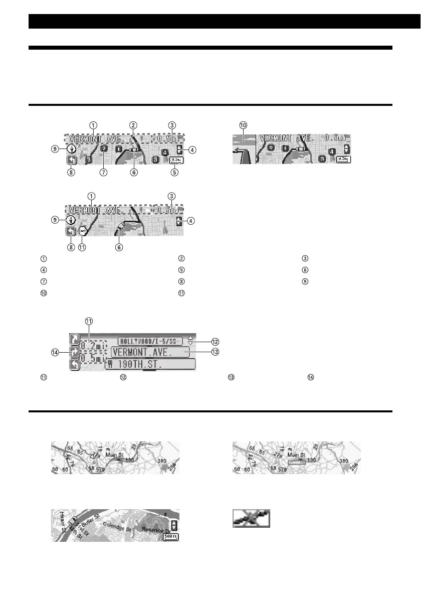
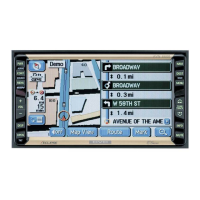
AREA SHOT Screen Configuration
The following two functions can be displayed in the Area Shot mode.
Route Assist mode : Displays the guidance by setting starting point and destination.
Town Map mode : Displays the surrounding of self-chosen area such as a sightseeing spot.
Route Assist mode
• Guidance point map : Displays a map on which the guidance point is centered.
• Route map : Displays a map showing the route to the next guidance point.
Text information The route to the destination Distance display
Manually selection icons* Scale Current position*
POI icons (guidance point map only)
Arrows Directional indicator
Guidance point (intersection) enlarged map
* Route section icon
Turn list display : A list for the 3 guidance points ahead of present point can be displayed.
Distance Manually selection icons* Guidance list Arrows
* Can be displayed only when GPS unit is connected.
Town Map mode
Specific area (town map) that user selected with E-iSERV can be displayed.
OVERALL VIEW : All over view of the area can be displayed.
CLOSE UP VIEW : Detail map for the area can be displayed.
Current position can be displayed only when GPS unit is connected.
When GPS reception is available:
Current position can be displayed.
The reduction scale map of the
selected range can be displayed.
The map is displayed with the scale.
* If the GPS signal cannot be
received with the GPS unit
connected, the icon will be
displayed.