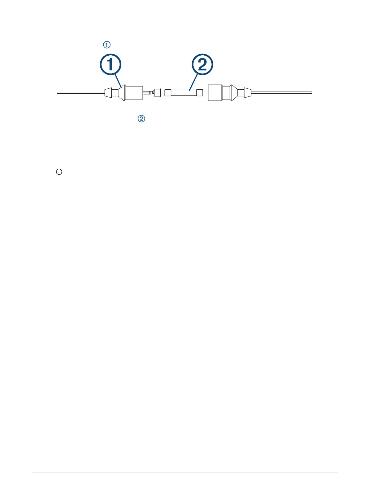
Changing the Fuse in the Power Cable
1 Open the fuse housing .
2 Twist and pull the fuse to remove it .
3 Insert a new 3A fast-blow fuse.
4 Close the fuse housing.
My sonar does not work
• Ensure the locking ring on sonar cable connector is secured.
• Press , and ensure sonar is enabled.
• Select the correct transducer type (Selecting the Transducer Type, page60).
My device is not creating waypoints in the correct location
You can manually enter a waypoint location to transfer and share data from one device to the next. If you have
manually entered a waypoint using coordinates, and the location of the point does not appear where the point
should be, the map datum and position format of the device may not match the map datum and position format
originally used to mark the waypoint.
Position format is the way in which the GPS receiver's position appears on the screen. This is commonly
displayed as latitude/longitude in degrees and minutes, with options for degrees, minutes and second, degrees
only, or one of several grid formats.
Map datum is a math model which depicts a part of the surface of the earth. Latitude and longitude lines on a
paper map are referenced to a specific map datum.
1 Find out which map datum and position format was used when the original waypoint was created.
If the original waypoint was taken from a map, there should be a legend on the map that lists the map datum
and position format used to create that map. Most often this is found near the map key.
2 Select Settings > Units.
3 Select the correct map datum and position format settings.
4 Create the waypoint again.
My device does not display the correct time
Time is set by GPS position and time zone setting.
1 Select Settings > Units > Time Zone.
2 Ensure the device has a GPS fix.
Garmin Support Center
Go to support.garmin.com for help and information, such as product manuals, frequently asked questions,
videos, software updates, and customer support.
116 Appendix