Heading Line and Angle Markers
The heading line is an extension drawn on the map from the bow of the boat in the direction of travel. Angle
markers indicate relative position from the heading or course over ground, which are helpful for casting or
finding reference points.
Setting the Heading Line and Angle Markers
The heading line is an extension drawn on the map from the bow of the boat in the direction of travel. Angle
markers indicate relative position from the heading or course over ground, which are helpful for casting or
finding reference points.
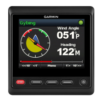
You can show the heading line and the course over ground (COG) line on the chart.
COG is your direction of movement. Heading is the direction the bow of the boat is pointed, when a heading
sensor is connected.
1 From a chart, select Menu > Layers > My Vessel > Heading Line > Angle Markers.
2 If necessary, select Source, and select an option:
• To automatically use the available source, select Auto.
• To use the GPS antenna heading for COG, select GPS Heading (COG).
• To use data from a connected heading sensor, select Heading.
• To use data from both a connected heading sensor and the GPS antenna, select COG and Heading.
This displays both the heading line and the COG line on the chart.
3 Select Display, and select an option:
• Select Distance > Distance, and enter the length of the line shown on the chart.
• Select Time > Time, and enter the time used to calculate the distance your boat will travel in the specified
time at your present speed.
Turning on Angle Markers
You can add angle markers to the map along the heading line. Angle markers can be helpful for casting when
fishing.
1 Set the heading line (Setting the Heading Line and Angle Markers, page16).
2 Select Angle Markers.
16 Charts and 3D Chart Views