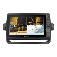
Waypoints
Waypoints are locations you record and store in the device. Waypoints can mark where you are, where you are
going, or where you have been. You can add details about the location, such as name, elevation, and depth.
Marking Your Present Location as a Waypoint
From any screen, select Mark.
Creating a Waypoint at a Different Location
1 From a chart, select Nav Info > Waypoints > New Waypoint.
2 Select an option:
• To create the waypoint by entering position coordinates, select Enter Coordinates, and enter the
coordinates.
• To create the waypoint using a chart, select Use Chart, select the location, and select Select Position.
• To create the waypoint using a range (distance) and bearing, select Enter Range/Bearing, and enter the
information.
Marking an MOB Location
Select Mark > Man Overboard.
An international man overboard (MOB) symbol marks the active MOB point and the chartplotter sets a direct
course back to the marked location.
Projecting a Waypoint
You can create a new waypoint by projecting the distance and bearing from a different location. This can be
helpful when creating sail racing start and finish lines.
1 Select Nav Info > Waypoints > New Waypoint > Enter Range/Bearing.
2 If necessary, select a reference point on the chart.
3 Select Enter Range/Bearing.
4 Enter the distance, and select Done.
5 Enter the bearing, and select Done.
6 Select Select Position.
Viewing a List of all Waypoints
Select an option:
• Select Nav Info > Waypoints.
• From a chart or 3D chart view, select Menu > Waypoints & Tracks > Waypoints.
Editing a Saved Waypoint
1 Select Nav Info > Waypoints.
2 Select a waypoint.
3 Select Review > Edit.
4 Select an option:
• To add a name, select Name, and enter a name.
• To change the symbol, select Symbol.
• To move the position of the waypoint, select Position.
• To change the depth, select Depth.
• To change the water temperature, select Water Temp..
• To change the comment, select Comment.
Navigation with a Chartplotter 33