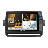
Depth Range Shading
You can set color ranges on your map to show the water depths where your target fish are currently biting. You
can set deeper ranges to monitor how quickly the bottom depth changes within a specific depth range. You can
create up to ten depth ranges. For inland fishing, a maximum of five depth ranges can help reduce map clutter.
The depth ranges apply to all charts and all bodies of water.
Some Garmin LakeVü
™
and premium supplemental charts have multiple depth range shading by default.
Red From 0 to 1.5m (from 0 to 5ft.)
Orange From 1.5 to 3m (from 5 to 10ft.)
Yellow From 3 to 4.5m (from 10 to 15ft.)
Green From 4.5 to 6.1m (from 15 to 20ft.)
To turn on and adjust, from a chart, select Menu > Layers > Water > Depth Shading.
Fish Eye 3D Settings
NOTE: This feature is available with premium charts, in some areas.
From the Fish Eye 3D chart view, select Menu.
View: Sets the perspective of the 3D chart view.
Tracks: Shows tracks.
Sonar Cone: Shows a cone that indicates the area covered by the transducer.
Fish Symbols: Shows suspended targets.
Supported Maps
To help you have a safe and enjoyable time on the water, Garmin devices only support official maps produced
by Garmin or an approved third party producer.
You can purchase maps from Garmin. If you purchase maps from a seller other than Garmin, investigate the
seller before purchasing. Be extra cautious with online sellers. If you have purchased an unsupported map,
return it to the seller.
26 Charts and 3D Chart Views