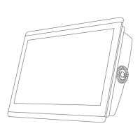
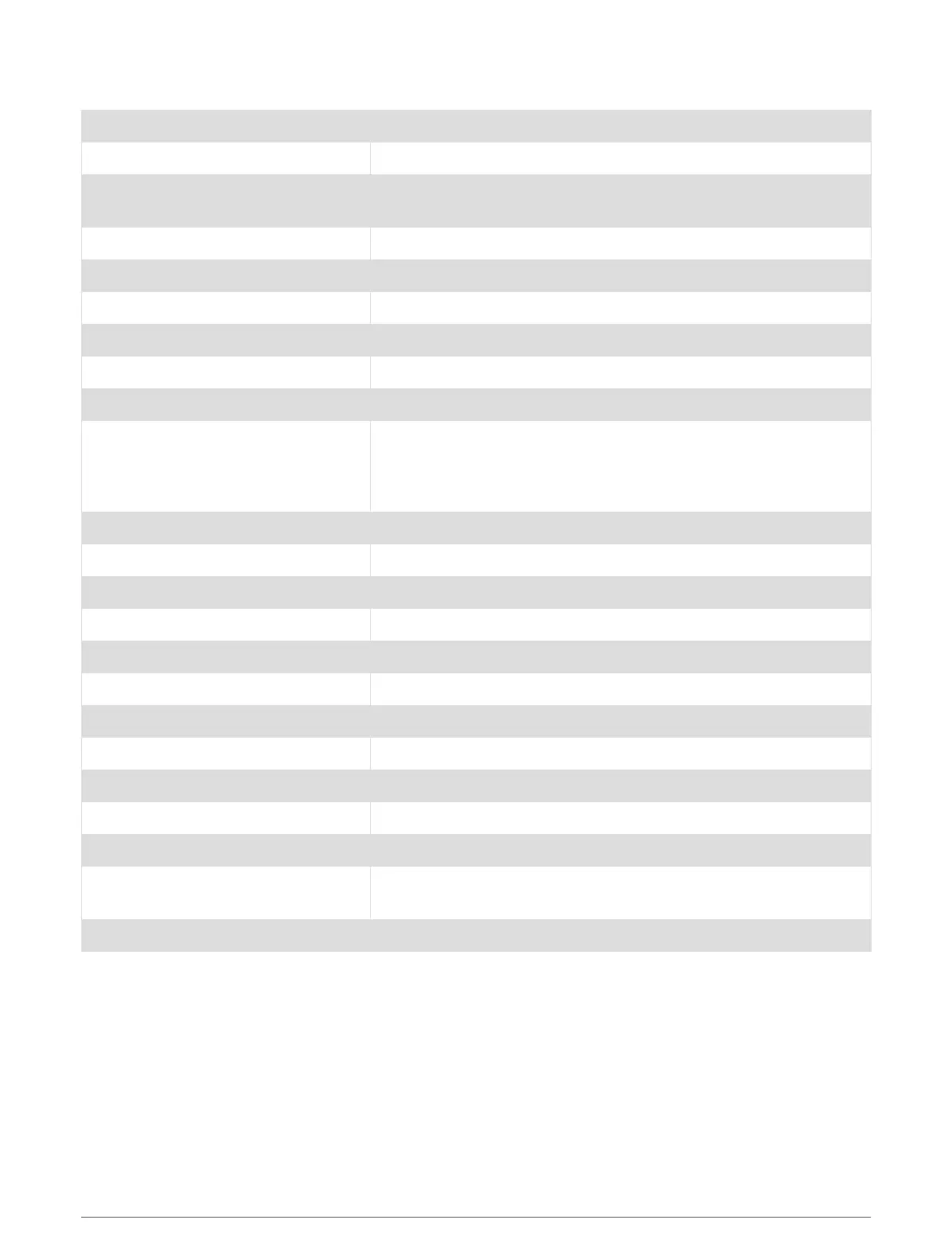
GPSMAP 8x16 Specifications
Dimensions (W × H × D) 384.7 × 262.6 × 76 mm (15
1
/
8
× 10
5
/
16
× 3 in.)
Dimensions on bail mount (W × H × D) 405.6 × 279.1 × 103 mm (15
15
/
16
× 11 × 4
1
/
16
in.)
Display size (W × H)
345.2 × 194.6 mm (13
9
/
16
7
11
/
16
in.)
15.6 in. diagonal
Display resolution FHD, 1920 × 1080 pixels
Weight 4.4 kg (9.6 lb.)
Clearance behind flush-mounted device 11.1 cm (4
3
/
8
in.)
Compass-safe distance 105 cm (41.3 in.)
Temperature range From -15° to 55°C (from 5° to 131°F)
Material Polycarbonate plastic and die-cast aluminum
Water rating
IEC 60529 IPX7
The device withstands incidental exposure to water of up to 1 m for
up to 30 min. For more information, go to www.garmin.com/water
rating.
Fuse 10 A, 125 V fast-acting
Input voltage From 10 to 32 Vdc
Max. power usage at 10 Vdc 52.1 W
Typical current draw at 12 Vdc 1.3 A
Max. current draw at 12 Vdc 6.0 A
NMEA 2000 LEN @ 9 Vdc 2
NMEA 2000 draw 75 mA max.
Max. waypoints 5,000
Max. routes 100 (250 waypoints each)
Max. active track points 50,000 points, 50 saved tracks
Memory card 2 microSD card slots in the back of the device; 32 GB max. card size
Wireless frequency and protocols
Wi‑Fi and ANT technologies
2.4 GHz @ 12.3 dBm nominal
HTML integration Compatible with OneHelm integration
Appendix 183