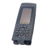
Magellan GPS ColorTRAK 7
Using your GPS ColorTRAK
The constellation of 24 GPS satellites circling the globe is in constant
motion, before your receiver can tell you where you are, it needs to know
where the satellites are relative to itself. It does this with the use of an
internal almanac, where it has stored in memory a general location for
each of the satellites. The almanac tells the receiver which satellites are in
view, based on the time, date and location of the receiver.
Until the ColorTRAK is initialized, it may not know its location, time or
date, therefore, it does not have a reference point to select which satellites
to use. Inputting the initial position, time and date is called initializing
your receiver, which will save you time. Initializing enables the receiver
to begin tracking satellites, and calculating your position, much faster.
Proper Handling - Signal Reception
Because the GPS ColorTRAK receives information it needs from
satellites orbiting the earth, the antenna needs to be raised with a
relatively unobstructed view of the sky.
Clear View of the Sky
The receiver needs a clear view of the sky, allowing it to choose from all
the satellites currently available.
If the view of the sky is poor, (large cliffs or buildings, heavy foliage or
other obstructions) the satellite signals can be blocked and the GPS
ColorTRAK may take longer to compute a position fix.
 Loading...