Magellan GPS ColorTRAK 17
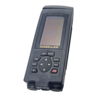
The NAV 1 screen displays a numerical reading at 30˚ increments with the
characters N (0°), S (180°), E (90°) and W (270°). Course is shown
numerically and represented by the Position Icon at the bottom of the screen.
Above the compass, bearing will be displayed with the icon of the destination
waypoint. When the bearing to your destination cannot be displayed within
the confines of the displayed compass, an arrow will be displayed either on
the right or left to indicate the steering direction.
Ideally, when you are navigating, the Position Icon and the Destination Icon
should line up, one above the other.
Position Icon
Destination
Name
Destination Icon
Compass
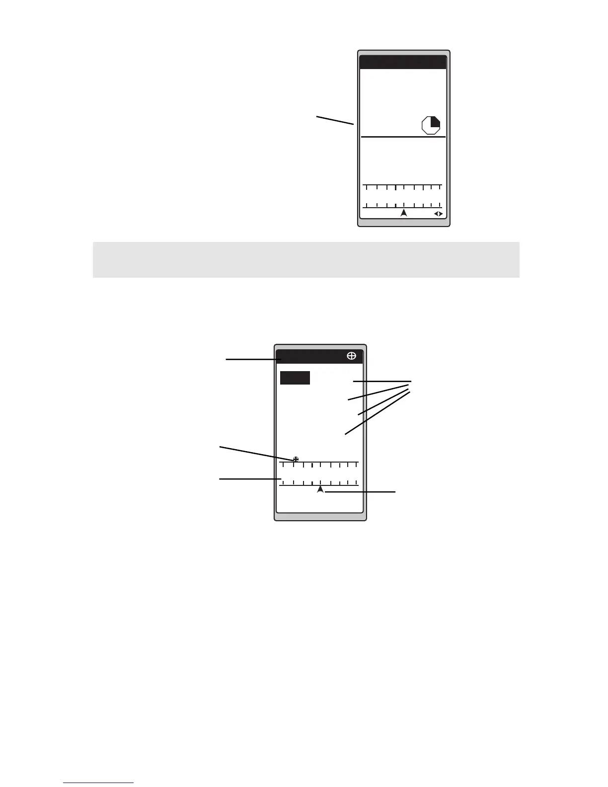
Selectable
Navigation
Data
Using the
NAV 1
Screen
The NAV 1 screen displays your destination along with four selectable
navigation measurements and a graphical compass.
When your speed is zero, the
receiver is in automatic
averaging mode, the date and
EPE will be replaced by the
averaging timer, as shown.
50.2
SOG
8.2
XTE
3.80
R
VMG
7.2
BRG
COG
150
150
120 S
K
T
K
T
n
m
127
°
m
n
m
°
m
TO: CAMP
DST
150
120 S
K
T
n
m
m
POSITION
N
34
˚
06.52
117˚49.56
W
ELEV 10900 FT
11:23:35 PM
SPEED
5.38
TRIP
238.8
COURSE 150
AVERAGING
00:00:35
°
 Loading...