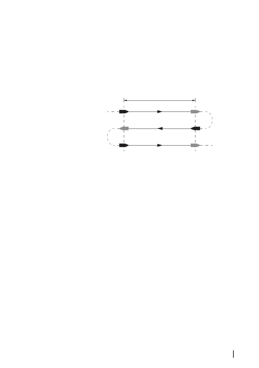
Referring to the diagram, A and B are the markers for each run. X is
the actual distance for each run.
• Enter the desired distance in nautical miles that you would like to
calculate the distance reference over
• When the boat gets to the predetermined starting position of the
distance reference calculation, start the calibration timer
• As the boat passes marks A and B on each run, instruct the
system to start and stop and finally OK to end calibration.
Use SOG as boat speed
If boat speed is not available from a paddle wheel sensor, it is
possible to use speed over ground from a GPS. SOG will be
displayed as boat speed and used in the true wind calculations and
the speed log.
Wind
MHU (Masthead unit) alignment
This provides an off set calibration in degrees to compensate for any
mechanical misalignment between the masthead unit and the
center line of the vessel.
To check the masthead unit alignment error we recommend you
use the following method which involves a sailing trial:
• Sail on a starboard tack on a close hauled course and record the
wind angle, then repeat the process on a port tack
• Divide the difference between the two recorded numbers and
enter this as the wind angle off set
If the starboard apparent wind angle is greater than the port angle,
then divide the difference by 2 and enter this as a negative offset.
Software setup | IS42 Operator Manual
55