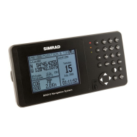
About GPS Navigation
This GPS receiver is a precision navigation instrument
utilizing the latest technology available today to provide
optimum performance from the GPS satellite and Beacon
land signals received. As with all other forms of radio
signals, the ultimate navigation result is dependent upon
the quality of these signals. Radio signals may, on occa-
sion, be distorted, jammed, or otherwise incorrect. As a
result, your position accuracy may occasionally be less
than that which can normally be expected.
The Navstar Global Positioning System, commonly re-
ferred to as GPS, is a satel lite navigation system devel-
oped by the U.S. Department of Defense to provide both
military and civilian users with highly accurate, world-
wide, three dimensional navigation and time. By receiv-
ing signals from orbiting GPS satellites, authorized users
are able to continuously navigate with an accuracy on the
order of 5 meters 2D RMS or better
A technique referred to as Differential GPS (DGPS), al-
lows users to obtain maximum accuracy from the GPS
system. DGPS requires the use of two GPS receivers.
One receiver, known as the Reference Station, is placed
at a surveyed location, the coordinates of which are pre-
cisely known. The purpose of the differential GPS system
is to use the reference station to measure the errors in
the GPS signals and to compute corrections to remove
the errors. The corrections are then communicated in
real-time to the navigators, where they are combined
with the satellite signals received by the navigators,
thereby improving their navigation or positioning. The
geographic validity of these corrections decreases with
distance from the reference station, but the corrections
are valid for navigators hundreds of kilometers from the
reference station.
Marine radio beacons operating in the 283.5 to 325.0 KHz
frequency range are in widespread use for direction find-
ing in coastal navigation. Because the beacon system has
been in place and widely used for many years, it provides
an effective means for the transmission of DGPS signals.
Depending on their local environment and power output,
their signals may be usable to several hundred miles.
Marine beacons provide an economical means of obtain-
ing DGPS accuracy for coastal navigators. GPS receivers