Charts
The chart function displays your vessel’s position relative to land and other chart objects. On
the chart panel you can plan and navigate routes, place waypoints, and display AIS targets.
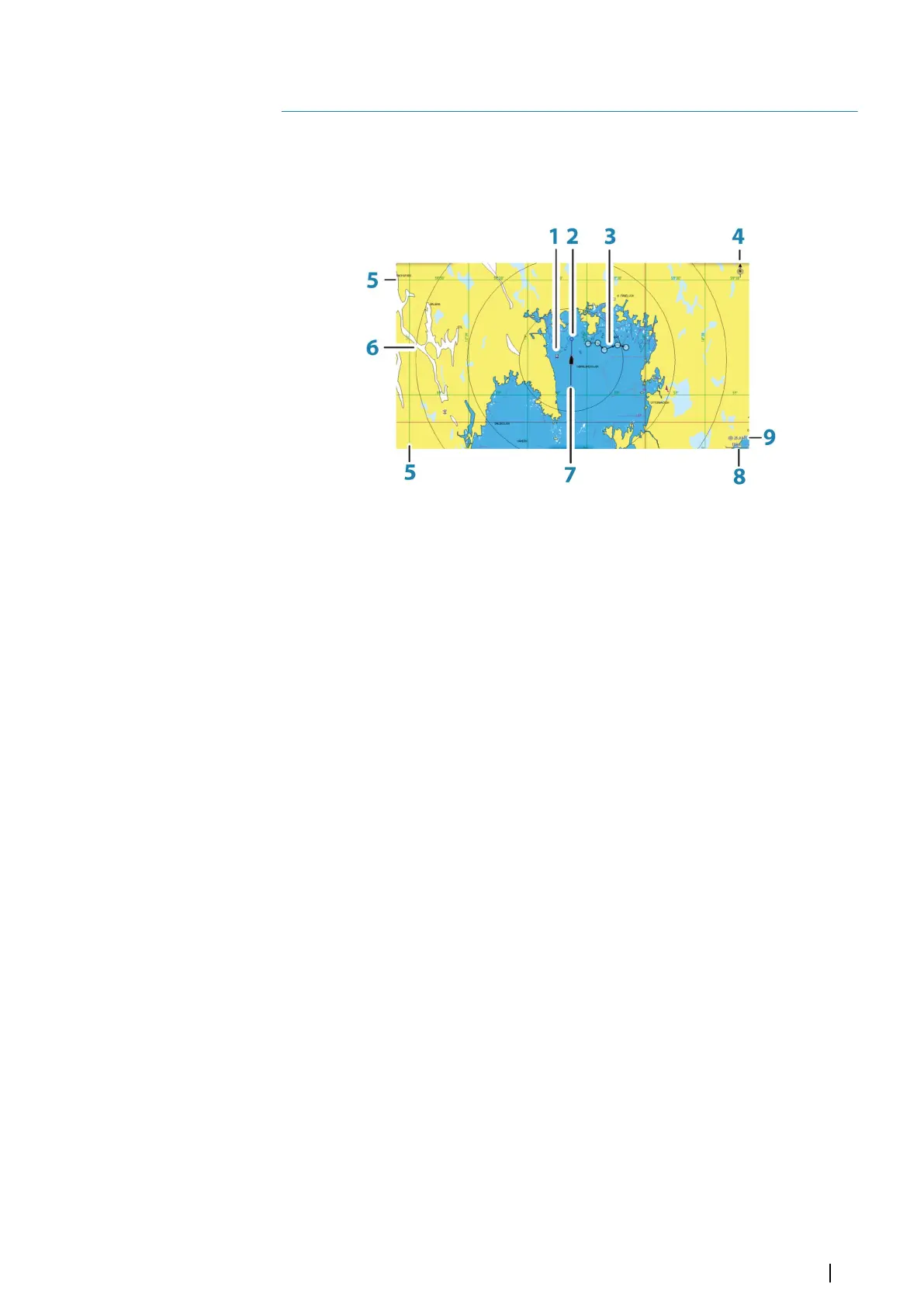
The Chart panel
1 Waypoint*
2 Vessel with extension line (extension line is optional)
3 Route*
4 North indicator
5 Grid lines*
6 Range rings*
7 Track*
8 Chart range scale
9 Range rings interval (only displayed when Range rings are turned on)
* Optional chart items. You turn the optional chart items on/off individually from the Chart
settings dialog.
Chart data
The system is delivered with different embedded cartography depending on region.
All units support Insight charts from Navico including Insight Genesis. The system also
supports charts from Navionics and C-MAP as well as content created by a variety of third
party mapping providers in the AT5 format. For a full selection of available charts, visit
www.gofreeshop.com, www.c-map.com, or www.navionics.com.
Ú
Note: In this manual, all possible chart menu options are described. These options vary
depending on the chart you are using.
Charts on chart cards are shared over the Ethernet network, so only one chart card per vessel
is required.
Ú
Note: The system does not automatically switch to embedded cartography if the chart
card is removed. A low-resolution chart will be displayed until you re-insert the card or
manually switch back to the embedded cartography.
Showing dual chart types
If you have different chart types available - embedded, in the card slot, or on the Ethernet
network - you can show two different chart types simultaneously on a page with two chart
panels.
4
Charts | NSS evo3 Operator Manual
25