Waypoints, Routes, and Tracks
Waypoints
A waypoint is a user generated mark positioned on a chart, on a radar image or on the
Echosounder image. Each waypoint has an exact position with latitude and longitude
coordinates. A waypoint positioned on the Echosounder image has a depth value, in
addition to position information. A waypoint is used to mark a position you later may want to
return to. Two or more waypoints can also be combined to create a route.
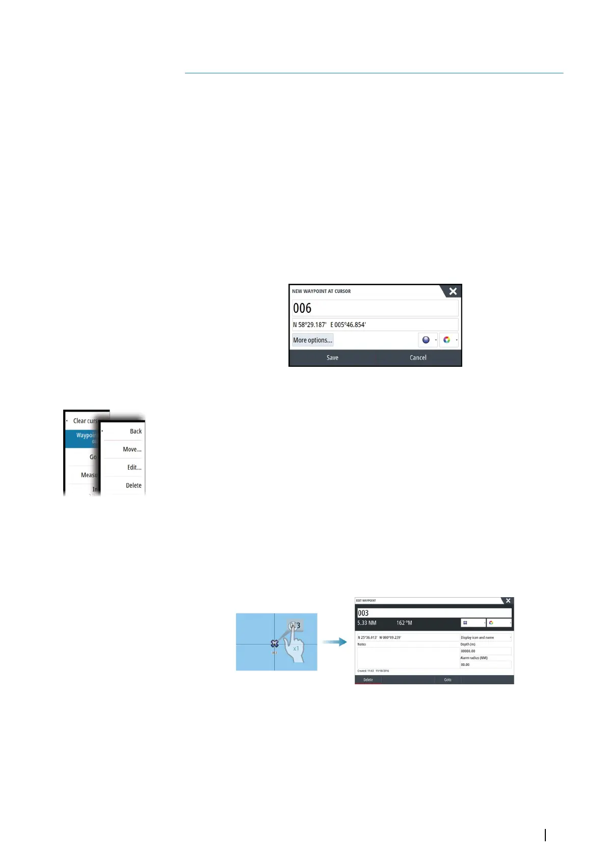
Saving waypoints
A waypoint is saved at the cursor position if active or at the vessel's position if the cursor is
not active on the panel, by doing the following:
• Pressing the rotary knob
• Pressing the Mark key
• Using the new waypoint option in the menu
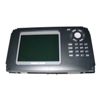
Moving a waypoint
1. Select the waypoint you want to move. The waypoint icon expands to indicate that it is
active.
2. Activate the menu and select the waypoint in the menu
3. Select the move option
4. Select the new waypoint position
5. Press the Enter key or the rotary knob to confirm the new position.
The waypoint is now automatically saved at the new position.
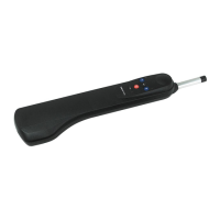
Edit a waypoint
You can edit all information about a waypoint from the Edit Waypoint dialog.
This dialog is activated by selecting the waypoint's pop-up, by pressing the rotary knob, or
from the menu when the waypoint is activated.
The dialog can also be accessed from the Waypoints tool on the Home page.
Waypoint alarm settings
You can set an alarm radius for each individual waypoint you create. The alarm is set in the
Edit Waypoint dialog.
Ú
Note: The waypoint radius alarm must be toggled ON in the alarm dialog to activate an
alarm when your vessel comes within the defined radius. For more information, refer to
"Alarms dialog" on page 118.
5
Waypoints, Routes, and Tracks | NSS evo3 Operator Manual
37