Version 15.0 AF-5000 Series Pilot Guide 97
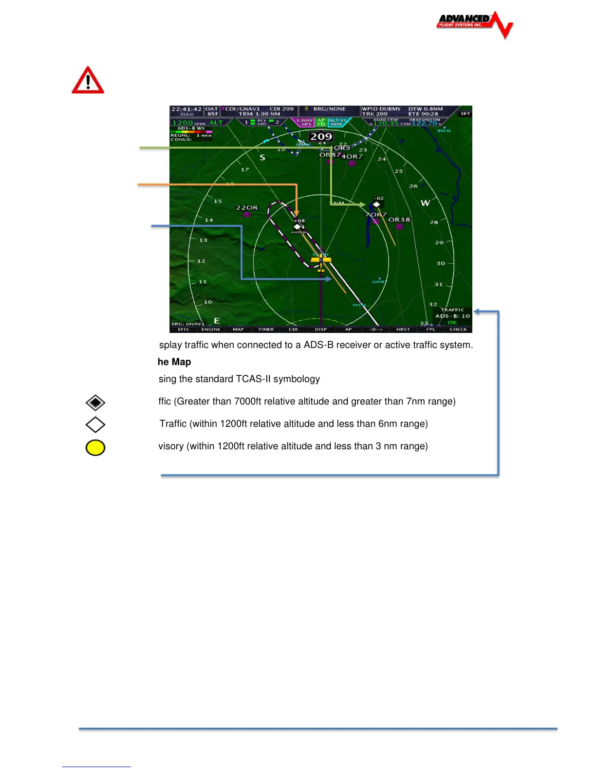
Map Traffic Display
WARNING: Traffic information displayed on the Map is provided for visually assisting in acquiring
other aircraft. The aircraft should be maneuvered based only upon ATC guidance or positive visual
acquisition of conflicting aircraft.
Traffic 200ft below
Traffic 800ft above
and descending
Traffic direction and 2
minute arrow
The AFS-Map can display traffic when connected to a ADS-B receiver or active traffic system.
Traffic Display on the Map
Traffic is displayed using the standard TCAS-II symbology
Other Traffic (Greater than 7000ft relative altitude and greater than 7nm range)
Proximity Traffic (within 1200ft relative altitude and less than 6nm range)
Traffic Advisory (within 1200ft relative altitude and less than 3 nm range)
Receiver Status
The TRAFFIC display in the lower right area of the Map Page annunciates both the device that is currently
providing traffic and the status of the traffic receiver.
Possible devices and their possible states include:
ADS-B: Any ADS-B source – such as the SV-ADSB.
• OK: Signifies that the transponder is communicating with the US-based ADS-B ground stations; that
those ground stations are replying to the ADS-B Receiver; and that your aircraft is in a known radar
service volume. This allows the ADS-B ground stations to report all ADS-B targets and radar-only
targets that are not yet ADS-B out equipped, thus providing a full traffic picture.
• NO RADAR: ADS-B system is reporting that it does not know about radar traffic targets, or that it is
not receiving information from any ADS-B ground station (in this case, you may still see aircraft that
are equipped with 978 MHz ADS-B out devices via the ADS-B receiver). Although you are receiving
ADS-B traffic from other ADS-B equipped aircraft, you are not receiving all detectable traffic because
you are not currently in a radar service volume and ADS-B service volume. Thus, the traffic portrait
may be incomplete.