.
Audio and Telematics
225
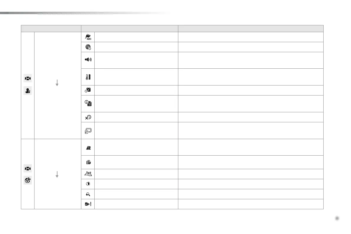
Level 1 Level 2 Comments
Navigation
User settings
Language Displaythelistoftextlanguagesavailable.
Time zone Displaythelistoftimezones.
Volume
Setthevolumeforvoiceinstructions,with"Test"and"Mute"(off)
buttons.
Units Changebetweenmetricandimperialunitsfordistanceandaltitude.
Date and time format dd/mm/yyyyormm/dd/yyyy12.00(midday)+12.00(midnight)or24.00.
Regarding
Displayinformationonthenavigationsystem:mappingsoftware
version.
Delete recent items Deleterecentdestinations.
Reinitialisation
Returnthenavigationsystemtothedefaultsettings.
Thisdoesnotaffectyourlistof"Favorites".
Navigation
Map settings
Route settings
Routecalculationoptions:thisallowscertaintypesofroadstobe
avoided,suchastollroadsorpedestrianisedareas.
Map display Displayoptions:northupin2D,vehicledirectionupin2Dor3D.
Icons on the map HideordisplayiconsforPOIsonthemap.
Colours Mapcolouroptions:daylightornightview.
Automatic zoom Activateordeactivatetheautomaticzoomoption.
Speed check Activateordeactivatethespeedcheckalert.
 Loading...