SinoGNSS
○
R
T300 User Guide
38
6.5 Cogo
6.6 Localization-- Site Calibration and Reset Grid
6.6.1 Site Calibration
Site calibration is applied to convert projection from WGS 84 to Local coordinate
system. To conduct site calibration:
1. Import all known points (c1, c2, c3) into controller (see chapter 6.7).
2. Start base station successfully, measure all the known points by the rover (a1,
a2, a3).
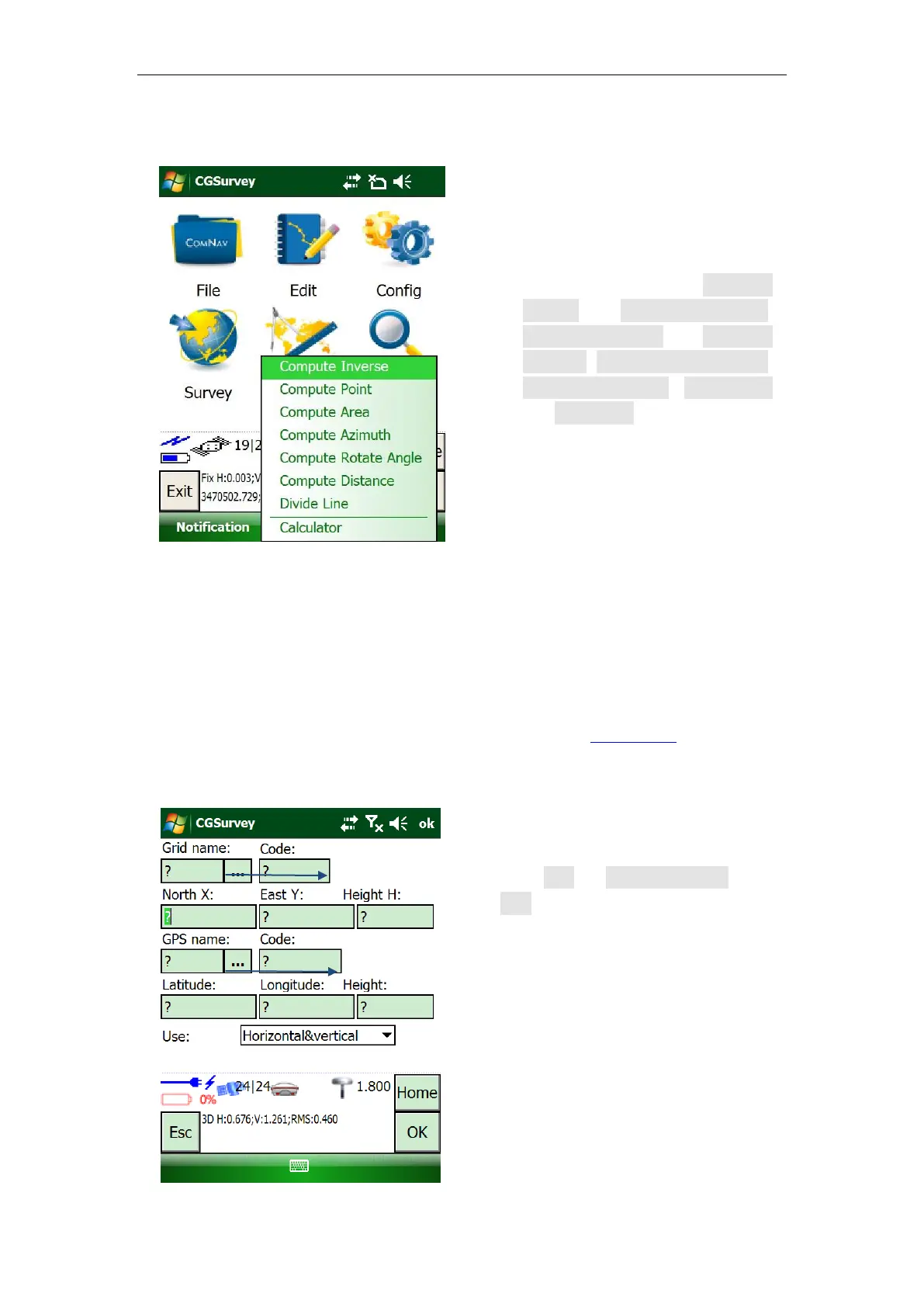
The function of COGO in
CGSurvey includes Compute
inverse, Compute point,
Compute area, Compute
azimuth, Compute rotate angle,
Compute distance, Divide line
and Calculator.
3. Click Edit -> Site Calibration ->
Add to pair known points with
measured points (c1->a1, c2->a2,
c3->a3).