SinoGNSS
○
R
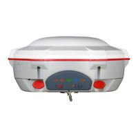
T300 User Guide
42
7 Specifications
Signal Tracking
•256 channels with simultaneously tracked satellite
signals
-GPS: L1, L2, L2C, L5
-BeiDou: B1, B2, B3
-GLONASS: L1, L2
-SBAS: WAAS, EGNOS, MSAS, GAGAN
Performance Specifications
•Cold start: <50 s
•Warm start: <30 s
•Hot start: <15 s
•Initialization time: <10 s
•Signal re-acquisition: <2 s
•Initialization reliability: >99.9%
Positioning Specifications
•Post Processing Static
-Horizontal: 2.5 mm + 0.5 ppm RMS
-Vertical: 5 mm + 0.5 ppm RMS
•Real Time Kinematic
-Horizontal: 8 mm + 1 ppm RMS
•E-RTK
1
(baseline<100 km)
-Horizontal: 0.2 m + 1 ppm RMS
-Vertical: 0.4 m + 1 ppm RMS
•Code differential GNSS positioning
-Horizontal: 0.25 m+ 1 ppm RMS
-Vertical: 0.5 m + 1 ppm RMS
•SBAS: Typically <1 m 3D RMS
•Standalone: <1.5 m 3D RMS
Communications
•1 Serial port (7 pin Lemo) Baud rates up to
921,600 bps
•UHF modem
2
: Tx/Rx with full frequency range
from 410-470 MHz
3
-Transmit power: 0.5-2W adjustable
-Range: 1-5 km
4
•3G module
-2 Bands GSM|GPRS EDGE 900/1800 MHz
-2 Bands UMTS| HSPA 900/2100 MHz
Support GSM, Point to Point/Points and NTRIP
•Position data output rates: 1Hz, 2Hz, 5Hz, 10Hz
•5 LEDs (indicating Power, Satellite Tracking, GPRS
Status and Differential Data)
•Bluetooth® : V 2.X protocol, work compatible with
Windows OS and Android
Data Format
Correction data I/O:
-RTCM 2.X, 3.X, CMR (GPS only), CMR+ (GPS only)
•Position data output:
-ASCII: NMEA-0183 GSV, RMC, HDT, VHD, GGA, GSA,
ZDA, VTG, GST, PJK, PTNL
-ComNav Binary update to 20Hz
Physical
•Size(W×H): 15.8 cm × 7.5 cm
•Weight: 0.95 kg (include 2 batteries)
Environmental
•Operating temperature: -40 °C to + 65 °C (40 °F to
149 °F)
• Storage temperature: -40 °C to + 85 °C (40 °F to
185 °F)
•Humidity: 100% condensation
•Waterproof and dust proof: IP67 protected from
temporary one meter immersion, floats.
•Shock: survives a 2 meter drop on to concrete
Electrical and Memory
•Input voltage: 5-27 VDC
•Power consumption: 2.85 W (3 constellations)
5
•Li-ion battery capacity: 2 × 1800 mAh, up to 8
hours typically
•Memory: 256 MB internal with up to 16 GB
pluggable memory card
Software
•ComNav field data collection software CGSurvey
•Carlson SurvCE field data collection software
(optional)
•MicroSurvey FieldGenius field data collection
software (optional)
1.E-RTK, BeiDou B3 signal used in RTK calculate engine;
concern the current situation, this mode can be used in
APAC; 2.ComNav Technology will remove UHF
modern according to different country’s regulation;
3 .410-470 MHz, 3 frequency range, 410-430, 430-450,
450-470 4.Radio work distance is related with many
environment factors, the maximum distance is 5 km in
very optimised situation; 5.Power consumption will
increase if using internal UHF as transmitter.