Viewing a Marine Forecast or an Offshore Forecast
1 Select Charts > Forecast.
2 Pan the chart to an offshore location.
The Marine Forecast or Offshore Forecast options appear when forecast information is available.
3 Select Marine Forecast or Offshore Forecast.
Viewing Forecast Information for Another Time Period
1 Select Charts > Forecast.
2 Select an option:
• To view the weather forecast for the next 48 hours, in 12-hour increments, select multiple times.
• To view the weather forecast for the previous 48 hours, in 12-hour increments, select multiple
times.
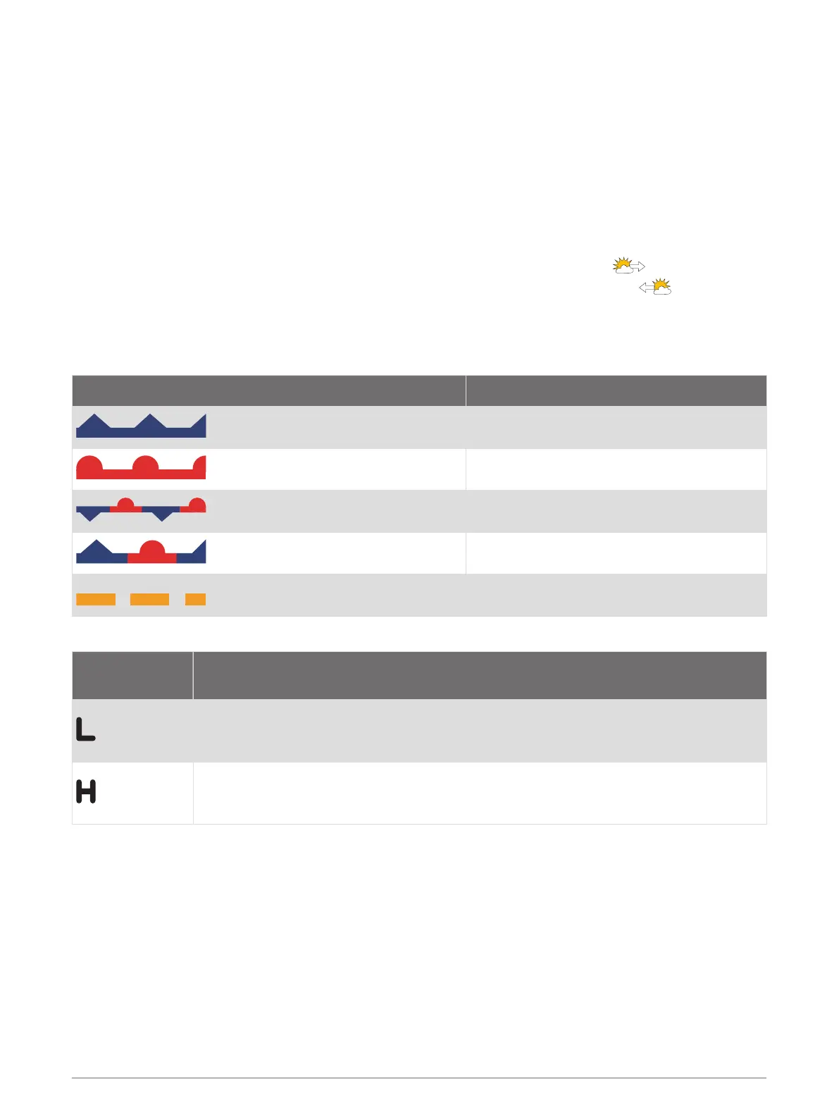
Weather Fronts and Pressure Centers
Weather fronts appear as lines that indicate the leading edge of an air mass.
Front Symbol Description
Cold front
Warm front
Stationary front
Occluded front
Trough
Pressure-center symbols often appear near weather fronts.
Pressure-Center
Symbol
Description
Indicates a low-pressure center, which is a region of relatively lower pressure. Moving
away from a low-pressure center results in increased pressure. Winds flow counterclock
wise around low-pressure centers in the northern hemisphere.
Indicates a high-pressure center, which is a region of relatively higher pressure. Moving
away from a high-pressure center results in decreased pressure. Winds flow clockwise
around high-pressure centers in the northern hemisphere.
SiriusXM Weather 131

 Loading...