2.9.4
DEFINITIONS & FORMULAS CHAPTER 9 GEODIMETER SYSTEM 600
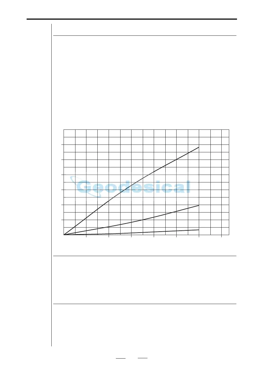
The correction for the earth's curvature and refraction that
has to be applied to the horizontal distance which has been
obtained by multiplying the slope distance by sine Z follows
the curve shown in the figure below. The correction is pro-
portional to the square of the slope distance and approxima-
tely directly proportional to the deviation from the horizon-
tal plane for moderate elevations.
Example:
Correction of the horizontal distance.
Signal height is the vertical distance between the point of the
rod and the centre of the target arrow marks on the reflector
system. Remember to take into consideration the penetration
depth of the ranging rod if working on very soft surfaces and
if carrying out accurate survey work!
Correction of horizontal distance
Signal Height
Instrument height is the vertical distance between the bench
mark/height point and the centre of the prism symbols on the
side of the instrument – i.e., the line of collimation of the
telescope.
Instrument Height
10
20
30
40
50
60
0
5 101520253035
Slope Dist. =
1000m
Slope Dist. =
500m
Slope Dist. =
200m
g
Correction (mm)