Applications Zoom | 135
9.6 Missing Line Measurement
Description Missing Line Measurement is an application used to compute slope distance,
horizontal distance, height difference and azimuth of two target points which
are either measured, selected from the memory, or entered using the keypad.
Missing Line
Measurement
methods
The user can choose between two different methods:
• Polygonal: P1-P2, P2-P3, P3-P4.
• Radial: P1-P2, P1-P3, P1-P4.
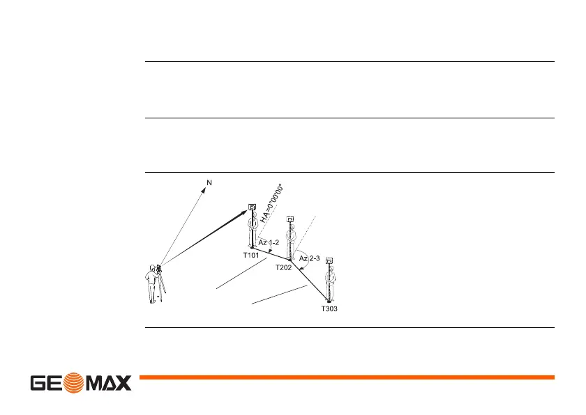
Polygonal
method
T101 1st target point
T202 2nd target point
T303 3rd target point
SD 1-2 Slope distance from T101-
T202
SD 2-3 Slope distance from T202-
T303
Az 1-2 Azimuth from T101-T202
Az 2-3 Azimuth from T202-T303

 Loading...


