Do you have a question about the Geonav 11 Flash and is the answer not in the manual?
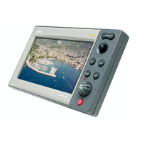
Overview of general features and capabilities.
Details on power supply, consumption, and protection.
Information on waypoint, track, and marker storage capacity.
Details on connectivity and data communication protocols.
Important safety and handling guidelines before installation.
Recommended methods for cleaning the unit's surfaces.
Instructions for mounting the unit into a panel.
Steps for flush mounting the unit into a panel.
Instructions for mounting the unit using a bracket.
Pin assignments for power and data connections.
Details on NMEA 0183, NMEA 2000, and auxiliary connectors.
Procedure for inserting the CompactFlash™ card.
Procedure for safely removing the CompactFlash™ card.
Description of the function of each button on the keyboard.
How to use the joystick and knob for navigation and selection.
Steps to access and run the unit's diagnostic program.
Information on chart content and how to display it.
Displaying navaid characteristics and port services.
Displaying tide and current forecast data.
Explanation of graphical items like markers, tracks, and boat position.
Description of route legs, waypoints, and sailing-specific indicators.
Switching on/off, welcome page, and operating modes.
Autozoom, Chart Rotation, EBL/VRM, and Easy Pilot functions.
Overzoom, position calibration, time, and display settings.
Guide to initial connection, cartridge insertion, and chart loading.
How to use the controls for navigation and menu interaction.
Mode for planning routes and editing waypoints.
Mode for displaying boat position and navigation data.
Displays tracked satellites, signal quality, and GPS fix status.
Shows speed, chart range, course, depth, and temperature.
Shows speed, chart range, target waypoint, time, distance, bearing, and depth.
Shows boat speed, VMG, chart range, true wind speed and direction.
Displays target waypoint, distance, time to arrive, bearing, and angle to steer.
Visualizes sea depth as a graph and shows water temperature.
Shows forecast data for tides and currents, including time, height, speed, and direction.
Displays average speed, time, and distance covered during a trip.
Steps for adding, modifying, and deleting waypoints.
Procedures for saving routes to CompactFlash™ and retrieving them.
How to record, save, and manage track data.
How to delete tracks and set their display color and view segment data.
Steps for adding, changing symbols, names, and colors of markers.
Procedures for saving marker sets to CompactFlash™ and retrieving them.
Configuration options for chart display, depth, and names.
Advanced options for tracking, filtering, and calibration.
Setting local time, language, and display modes.
Navigating to selected waypoints or ports.
Navigating to nearest services or specific track segments.
Accessing tide and current data for survey stations.
How the GEONAV enables the autopilot to follow routes.
| Brand | Geonav |
|---|---|
| Model | 11 Flash |
| Category | Boating Equipment |
| Language | English |