5 - Operation
5.18
To po gra p hy
Press “Topography” button to enter the Topography screen which allows user to setup Topography
functionality.
The display allows you to record points that can be used to make a reference layer that is relative to the
elevation throughout the field. This can provide you with valuable information in regards to the highs
and lows of a field when you may not be able to visually tell with the naked eye. Surveying and Tiling
operations will probably benefit the most with respect of where to place the mains and laterals in a field.
ATTENTION! Requires RTK GPS signal to collect the accurate elevation data.
You can also import data from mapping software such as SMS Advanced via .agsetup files.
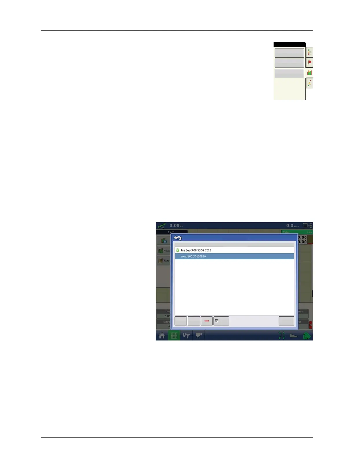
Topography screen
You are allowed to have multiple topographical elevation surveys for the same field. This can be useful for different
applications, for example:
• One topographical survey that is for the entire field. This will give you a greater perspective of the whole field.
• An additional topographical survey, driven at very dedicated portion of the field. This would allow you to have greater
elevation detail in certain areas if you need it.
By default the naming that is generated in the display will be Date/Time based. You can export surface elevation data from
software packages like SMS Advanced into the display, and those will be tagged with the field name and the date exported
(both examples are in the screen shot).
You can also add points to existing topographical surveys and save them.
Only one topographical survey can be active at a time. When exported as an .agsetup or .agdata file, this will be the survey
that is exported. Non-active surveys will stay in the display. At any time you can remove an topographical survey, and collect
a new one.
• New Survey button
Press to create a new topographical survey
• Add to Selected button
Press to add to an topographical survey
• Minus (-) button
Press to delete a topographical survey
• Enable check box
Press to turn topographical reference layer
on/off (Enable check box functions the same
as Topography check box in Map Options
screen - shown below.)
• Set Active
Select the desired topographical survey from
list and use button to set as active.
Field
Boundary
Headlands
Topography
New
Survey
Add to
Selected
To pog rap hy
Elevation Surveys
Enable
Set Active
 Loading...