5 - Operation
5.20
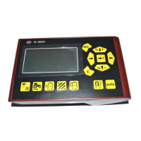
After the survey points have been collected, they
will be converted into a surface layer in which you
can define the color scheme Red, White, Blue, or
Brown-Tan. See “Map Legend tab” on page 3.8.
You can select the number of legend ranges for
your field that will show the areas desired. This
theme will be used for each field until changed.
Hues will represent:
Red, white, blue scheme
Darker blue = Lower elevation.
Darker red = Higher elevations.
White will be a transition color between.
Brown-Tan scheme
Dark brown = Lower elevations.
Tan = Higher elevations.
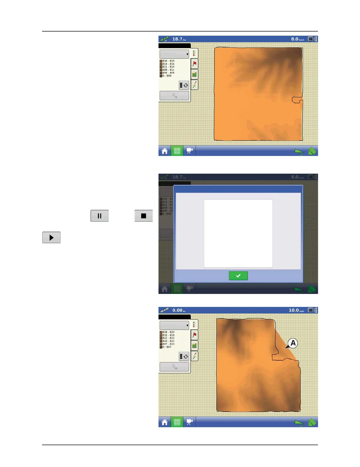
If at any point during collection your GPS
correction status changes out of RTK fixed, logging
will be suspended.
If you re-acquire the RTK signal, logging will
automatically resume.
At any point you can (pause) or
(stop) collection of the elevation survey, and then
(resume) as needed.
If you forget to stop logging as you leave the field,
you will be prompted with the message that data
collection is still active, and be given the option to
continue logging, or end operation.
In Odd-shaped fields, the surface rendering of the
elevation will connect areas (A) even if you haven’t
driven through that area.
No Product
Topography
the following items are outside the recommended accuracy
GPS Quality Warning
Low Fix Quality
No Product
Topography
 Loading...