91
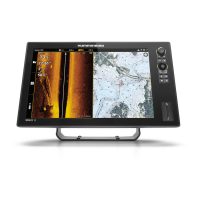
Navigation Menu Overview
Info Menu Options
Info
Select Info to search the area within a preset range for a variety of data, including
cautions, tide stations, current stations, and ports. The available information is
determined by the selected map source and the information available in the search
area. See Search for more information. (Navionics only)
Ruler
Select Ruler to measure the distance between two positions on the view. Press the
ENTER key to select the measurement start point. Move the Joystick to the second
selected position, and press the ENTER key to mark the measurement end point.
Lake List
Select Lake List to search for lakes within a preset range. Humminbird must be selected
as the map source. See Search for more information.
Lake Name
Select Lake Name to open the on-screen keyboard and search for a lake by name.
Humminbird must be selected as the map source. See Search for more information.
Find Nearest
Select Find Nearest to search the closest waypoints, routes, and tracks within a preset
range. See Search for more information.
Trolling Grid
Select Trolling Grid to apply a trolling grid to a position on the Chart View. See Waypoints
for more information.
AIS: All Inactive Select this menu to change all tracked AIS targets to inactive (see AIS and MARPA).
AIS List
Select this menu to display a list of all AIS targets within the AIS transmission range
(see AIS and MARPA).
MARPA: All Inactive Select this menu to cancel all MARPA targets (see AIS and MARPA).
MARPA List Select this menu to display a list of all MARPA targets (see AIS and MARPA).
Clear Lost Targets Select this menu to clear the list of lost targets from view.
 Loading...