32 Chapter 5 Learn Geode Connect for iPad and iPhone
Geode GNS3 Real-Time Sub-Meter GPS Receiver
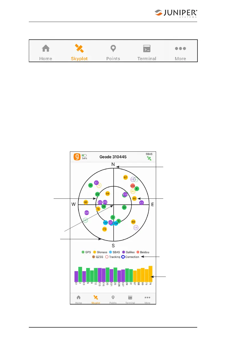
5.2 Skyplot Page
The Skyplot page shows which satellites are being used in
the positioning solution and where they are in the sky. It
also shows satellites that are being tracked by the Geode.
On the Skyplot page, each satellite is identified by a space
vehicle number (SVN) and color for its constellation. The
location of each satellite on the skyplot indicates where
it resides in the sky overhead relative to true north. The
outside ring is 0° elevation (horizon). The inside ring is 45°
elevation—halfway above the horizon from the Geode’s
present location. The intersection of the two lines indicates
directly overhead.
Signal
strength
Satellite
SVN and
constellation
color
True north
Directly
overhead
Horizon
45° above the
horizon
Legend