Chapter 7 Learn Geode Connect for Android 71
Owner's Manual
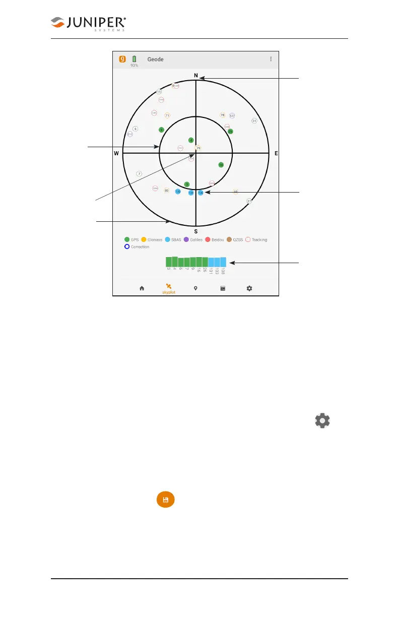
The Skyplot page is meant to be used as a guide. It shows
the relative visibility of satellites in the sky, but it is not an
absolute reference for satellites used in the positioning
solution.
Multi-GNSS Geode models support the Galileo, BeiDou,
GPS, QZSS, SBAS, and GLONASS constellations.
If the Skyplot page is not displaying data:
1. Go to the Settings page by tapping the gear icon in
the navigation bar.
2. Under Active GNSS Constellations, select Multi-GNSS.
3. Under NMEA Sentences, select GSV.
4. Tap the save icon .
True north
Satellite
SVN and
constellation
color
45° above the
horizon
Directly
overhead
Horizon
Signal strength