Baud rate: 115200 Data bits: 8
Parity: None Stop bits: 1
Terminator: CR/LF
Type 8 pin LEMO-1 USB2.0 Host
(A)
LEMO USB client
(high-speed)
CS20 F
or power and/or
communication
For communication
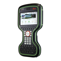
6.2 GS07
6.2.1 Tracking Characteristics
Multi-frequency
☞
Depending on the satellite systems and signals configured, a maxi-
mum number of 320 channels is allo
cated.
System Signal
GPS L1, L2, L2C, L5
GLONASS L1, L2, L3*
Galileo E1, E5a, E5b, AltBOC, E6*
BeiDou B1, B2, B3*
QZSS L1 C/A, L2C, L5
SBAS
(WAAS, EGNOS, MSAS,
GAGAN)
L-band
* Believe to comply, but subject to availability of BeiDou Inter
face Control
Document and Galileo commercial service definition.
Carrier phase and code measurements on L1, L2 and L5 (GPS) are fully inde-
pendent with AS o
n or off.
6.2.2 Accuracy
Accuracy is dependent upon various factors including the number of satellites
tr
ack
ed, c
onstellation geometry, observation time, ephemeris accuracy, iono-
spheric disturbance, multipath and resolved ambiguities.
The following accuracies, given as root mean square, are based on measure-
ments processed using LGO and on real-time measurements.
The use of multiple GNSS systems can increase accuracy by up to 30% relative
to GPS only.
The baseline precision of a differential code solution for static and kinematic
surveys is 25 cm.
Ports
Satellite reception
Instrument channels
Supported signals
☞
☞
Differential code
Technical Data 51