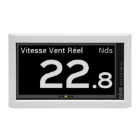
Page 42/55 68_Afficheur_Multidisplay_um_UK_11
Using the GPS mode
In GPS mode the Gyropilot steers the boat to a route provided by the GPS or the
navigation software connected to the NMEA input of your Topline system.
To achieve this, the
GPS or the navigation software must feed the system with the
following NMEA sentences:
- $xxXTE : cross-track error and
-
$xxBWC : bearing and distance to waypoint (DTW and BTW) or
- $xxRMB : XTE, latitude, longitude and bearing and distance to waypoint (DTW and
BTW as minimum data).
WARNING:
The GPS mode uses the “Cross-track error” provided by your GOS compared to the
course chosen.
The pilot uses this value to steer the boat and respect strictly the course over ground.
If you engage the pilot far from the route it will choose the shortest way to join it and
might steer hard. To avoid it, put your boat on the route before engaging your pilot or
engage the route on your map and engage the pilot.
It is therefore very important to be the closest from the route before engaging your
GPS mode because if the cross-track error is > to 0.4 Mn, the gyropilot will steer the
boat on the route with a 45° angle.
When arriving to the waypoint, if the next waypoint activation isn’t automatic, the pilot
rings, follows the compass heading and leave GPS mode. The skipper must
therefore verify that his route is free and that the direction of the next waypoint is
correct. Press AUTO again will engage the GPS mode, steering the boat toward the
next waypoint. The procedure must be repeated at each new Waypoint.
WARNING:
Your GPS or navigation software which is connected to the pilot may be able to
activate the next waypoint automatically. In that case the pilot will follow the route’s
legs accordingly.