Purpose
To perform external calibration/
adjustment on the weighing instrument
at a location other than the place of
installation.
The sensitivity of a weighing instrument
is directly affected by gravitational
acceleration, which in turn is dependent
on geographical latitude and elevation.
Thus when a weighing instrument is
moved from its place of installation and
used in another location, its sensitivity
is altered. In general, gravitational
acceleration increases in the direction
of the poles (i.e., with increasing
degree of latitude) and decreases with
increasing distance from the center
of the earth (i.e., with increasing
elevation).
If precise data concerning the place of
installation of the weighing instrument
is known; i.e., the geographical latitude
in degrees (north or south) and elevation
in meters above sea level, then the
instrument can be adjusted at the
factory for its intended place of
installation, provided that the same
data for the place of adjustment
(i.e., at the factory) is known. Rather
than geographical latitude and local
elevation, it is sufficient to know the
gravitational acceleration at the places
of adjustment and installation.
The following data, describing the place
of manufacture (Sartorius in Goettingen,
Weender Landstrasse 94-108) is used as
reference data:
– Geographical latitude:
51° 32’ = 51.53 degrees
– Elevation: 151 m
– Gravitational acceleration:
9.811590 m/s
2
If this reference data is stored in the
indicator, the adjustment factor does
not need to be corrected for the place
of installation.
After the menu access switch is closed,
the geographical data is stored in the
A/D converter.
The adjustment applies for the place of
location including a specific tolerance
zone. For example, the tolerance zones
for a scale with 3000 e are ± 100 km
for the latitude and ± 200 m for the
elevation above sea level.
75
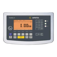
Entering Geographical Latitude, Elevation and Gravitational Acceleration
The following exception applies in
Germany for scales with 3000 e:
The scale can be used in legal metrology
anywhere in Germany (“Zone D”) if the
geographical data is as follows:
– Geographical latitude:
51.00 degrees
– Elevation: 513 m
This data corresponds to the
following value:
– Gravitational acceleration:9.810 m/s
2
These values are calculated for Germany
based on a mean value for the Earth’s
acceleration. The greater the precision
of the geographical data entered, the
greater the precision achieved with the
weighing instrument; the tolerance
range, however, is restricted accordingly
(see above.)
Procedure
The geographical data stored in the
indicator at the factory applies to
Germany (“Zone D”) (see above).
Before adjusting the complete weighing
system, make sure the geographical
reference data stored in the indicator
matches the values for the place of
adjustment (whether at the factory or at
the place of installation). If the values
do not match, enter the latitude and
elevation (or the gravitational accelera-
tion) in the corresponding input fields
of the “Geographical Data” menu,
which is a submenu of the “Calibra-
tion/Adjustment” menu, under “Device
Parameters.” Then adjust the scale.
If the place of adjustment is not the
same as the place of use, enter the data
that defines the place of use. Following
adjustment, close the menu access
switch. The scale can now be used at
the place of installation, or anywhere
within a tolerance zone (see above)
around the place of installation.
If the scale is installed in Germany,
you can enter the data for “Zone D”
(51.00 degrees, 513 m above sea level).
In this case, the scale can be used
anywhere within Germany. This setting
is recommended for weighing equip-
ment dealers, who thus do not need to
know the exact geographical data when
delivering to customers in Germany.
If a service technician performs a span
adjustment (for example, after one or
more load cells have been replaced),
it is conducted without changing the
values stored in the “Geographical
Data” menu. For this adjustment, either
the geographical latitude (“Latitude”)
and elevation (“Altitude”) or the
gravitational acceleration (“Gravit. acc.”)
for the place of installation must be
entered. This data can be obtained
from the relevant land registry or
Ordnance Survey.
The geographical data cannot be edited
unless the menu access switch is open.
If the indicator is part of a verified
weighing system, the verification seal
must be broken to change this data.
Afterwards, the scale must be re-verified.
If the gravitational acceleration has
been entered, then this value takes
precedence over the geographical lati-
tude and the elevation. In this case, the
input fields for latitude and elevation
show the values “99999.99” and
“9999999,” respectively, when you open
the input menu. In the converse case;
i.e., if the values for geographical lati-
tude and local elevation were entered,
these values are shown when you open
this menu. In both cases, the value for
gravitational acceleration is displayed as
“0.000000.”
To display geographical data during
the adjustment procedure, select
“Display geogr. data: Yes” in the
“Device Parameters” menu. The factory
default setting for this item is “No.”
When the setting is “Yes,” the indicator
shows which data (geographical latitude
and elevation, or gravitational accelera-
tion) is used. Press ) to confirm the
data. If necessary (for example, if the
geographical data does not apply for
the current place of adjustment), press
( to cancel the calibration procedure.
 Loading...