48
©
2018 DJI All Rights Reserved.
DJI GS RTK App
The DJI GS RTK app is designed for mapping applications. It can be used to plan operation areas and ight
routes, set various parameters, and view the status of the operations in real time.
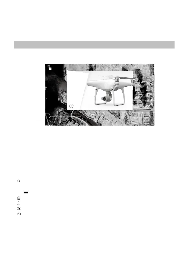
Main Screen
PHANTOM4
RTK
Plan Fly
Aircraft connected
Broad Vision
Precision Targeting
1
2
3
1. Plan a Field | Execute Operation
Plan: Tap the button and then select Photogrammetry or Waypoint Flight operation, and then enter
Planning View for planning.
Fly: Tap to enter Camera View or Map View to view the aircraft status, congure the settings and perform
operations.
2. Aircraft Connection Status
: Shows whether the aircraft is connected to the remote controller.
3. Menu
Tap to manage tasks, view user information, aircraft information, and congure general settings.
: Task Management — View the progress of operations, planned operations and imported KML les.
: User Info — View user information of the account logged in.
: Aircraft Info — View the information of the connected aircraft.
: General Settings — Tap for settings such as units of measurement, network diagnosis, and Android
system settings