©
2018 DJI All Rights Reserved.
49
Phantom 4 RTK User Manual
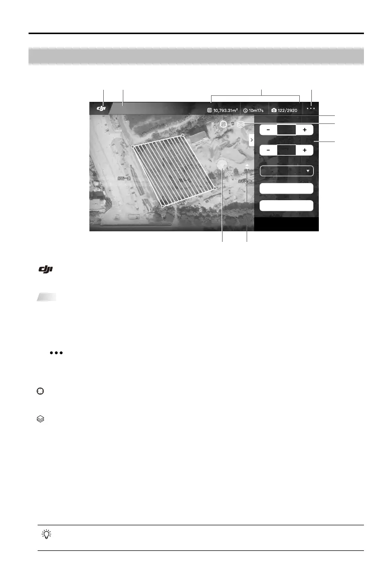
Planning View
Photogrammetry
Photogrammetry
Mapping Area Estimated Flight Time Photos/SD Card
Height(M)(GSD 2.74 cm/pixel)
100
Speed (M/s)
9.0
Finish
RETURN-TO-HOME
Camera Settings
Advanced Settings
Cancel
Save
1. Main Screen
: Tap this icon to return to the main screen.
2. Operation Type
Photogrammetry
: Shows the current type of operation being planned.
3. Planning Information
Shows the mapping area, estimated ight time, and number of photos.
4. More Settings
Tap to enter the extended menu to view and adjust the parameters of all other settings. Refer to the
introduction for Camera View.
5. Location
: Tap to center the map around the aircraft’s location or the latest recorded Home Point.
6. Map Mode
: Tap to switch among Standard, Satellite, or Night modes.
7. Operation Parameters Settings
This settings list will pop-up after edge points added by tapping on the map.
Height: The altitude of the aircraft during the operation.
Speed: The horizontal ight speed during the operation.
Finish: The aircraft action after the operation is completed. Choose from RTH, hovering, landing, and
back to the start point.
Camera Settings: Includes photo ratio, white balance, gimbal angle, shutter priority and distortion
correction.
If distortion correction is enabled, the image quality may be lower due to processing. It is
recommended to disable this option when original images are need for post processing.
1 2 4
5
6
89
7
3