20
©
2018 DJI All Rights Reserved.
Phantom 4 RTK User Manual
Industrial Applications
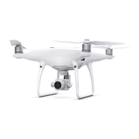
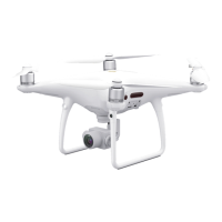
The Phantom 4 RTK can be used for industrial applications including but not limited to, photogrammetry
and power line inspections. Select Photogrammetry or Waypoint Flight, plan ight paths, set parameters,
and then the aircraft will perform automated operations. Operation resumption and obstacle avoidance are
available. Users can import images to the DJI PC GS Pro application or a third-party mapping software to
composite highly accurate maps for dierent applications. KML/KMZ les can be imported into the DJI GS
RTK app to help plan operations.
KML/KMZ File Import
To plan operations, insert the microSD card with the KML/KMZ les into the microSD card slot on the remote
controller to import the les into DJI GS RTK. For les including polygons, users can view the data on the
map and use it to plan ight areas. For les including line strings, users can only view the data on the map,
but cannot use it for planning.
Preparing Files
1. Create a folder named “DJI” in the root directory of the microSD card. Then create a folder named “KML”
under this folder. (The letters are not case sensitive.)
2. Store the KML/KMZ les into the “KML” folder created above.
Importing Files
1. Insert the microSD card into the microSD card slot on the remote controller. There will be a pop-up
window on the main screen in the DJI GS RTK app then. If not, tap , then tap .
2. Tap the le in the window to select it. To delete the le, swipe to the left and tap . Select les and then
tap to import the les. Wait until the app indicates successful import.
Viewing Files
1. Go DJI GS RTK main screen > > , select KML Files in the drop-down menu on the top to view the
les. They are sort by time. KML le names displayed in the app are the original names of the les. KMZ
les will be named in sequence: doc, doc(1), doc(2), etc.
2. Tap the icon on the right of each le to enter Map View and view the data on the map.
Users can also tap on the left in Camera View or Map View, and then select KML File in the
drop-down menu to enter the le list page.
3. Tap Edit to edit the waypoints for photogrammetry operation planning if the waypoint number is fewer
than 125. Refer to the Photogrammetry section below for details on operation planning. If the waypoint
number is more than 125, users have to reimport KML/KMZ les that meet the requirements.
Photogrammetry
After the operation area has been set, and settings have been congured, the DJI GS RTK app produces
a flight route based on the user’s input. After planning, the aircraft can carry out automated operations
following the flight route. There are two types of Photogrammetry operations: 2D and 3D. The 2D flight
route is s-shaped and can be used for 2D mapping. The 3D ight route consists of s-shaped routes that are
crisscrossed to create 3D maps. The default values of the gimbal pitch angle for the two types are dierent.
 Loading...


