50
©
2018 DJI All Rights Reserved.
Phantom 4 RTK User Manual
Advanced Settings: Includes horizontal overlapping rate, vertical overlapping rate and margin. The vertical
overlapping rate indicates the overlapping rate of two pictures captured consecutively along the same
path. The horizontal overlapping rate indicates the overlapping rate of two pictures on two parallel paths.
8. Map Zoom In/Out
: Tap to show the slider, and then slide it to zoom in or out.
9. Route Direction
: The system automatically produces ight routes after adding edge points and setting parameters.
Tap and drag this icon to adjust the ight direction of the produced route. Tap the icon for ne tuning in
the pop-up menu.
Waypoint Flight
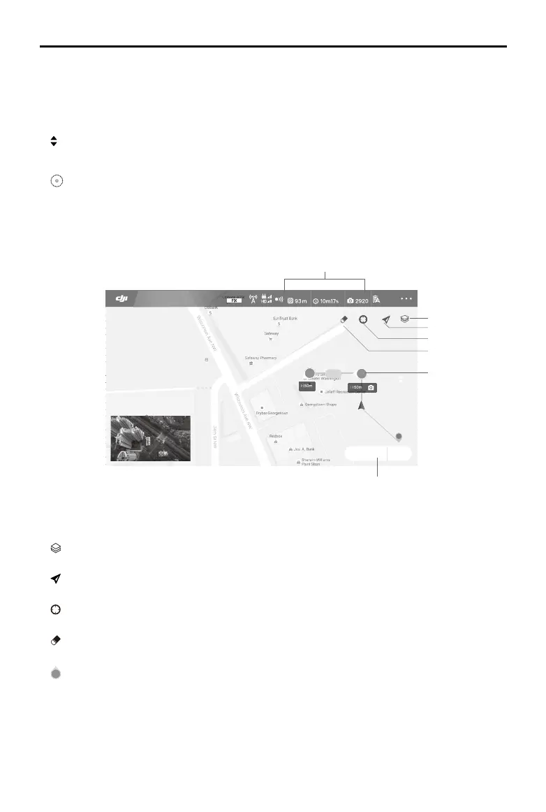
1. Planning Information
Shows the planned route length, estimated ight time, and microSD card capacity.
2. Map Mode
: Tap to switch among Standard, Satellite, or Night modes.
3. Location Follow
: Tap to center the map around the aircraft’s location at all times, following its location update.
4. Location
: Tap to center the map around the aircraft’s location or the latest recorded Home Point.
5. Clear Screen
: Tap to clear the ight path currently shown on the map.
6. Waypoints
2
: The waypoints added by pressing the C2 Button on the remote controller. Tap to set the ight altitude,
heading, speed, gimbal angle and waypoint actions of each waypoint, switch among waypoints, and
delete the waypoint.
7. Route Settings | Save
Route Settings: Tap to enter the route settings menu to set task ending action, remote controller signal
loss action, aircraft heading in relevance to the ight route, cruising speed and route recording.
Other elements in this view are the same as the ones in Camera View.
99%
Route Settings Save
93 m
H
2
1
RTK
12
D 10.0M/SH 10.0M
V.S: 0.0M/S H.S: 3.3M/S
In Flight (RTK)
Route Length
Estimated Flight Time SD Card
1
7
2
6
3
4
5